The Beartooth Highway is a remarkable road that goes over the plateau of the Beartooth uplift. Much of the road is over 10,000 feet (~3000 m) and above treeline. The road is not open all year, so check for road conditions and keep an eye on the weather. The exposed rocks include a wide array of Archean igneous and metamorphic rocks, some Paleozoic sediments, and a spectacular array of Pleistocene features, including glacial lakes and valleys, patterned ground, and rock glaciers.
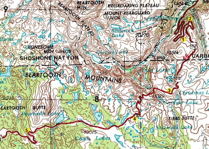
Map, showing Beartooth Highway and field trip stop locations.
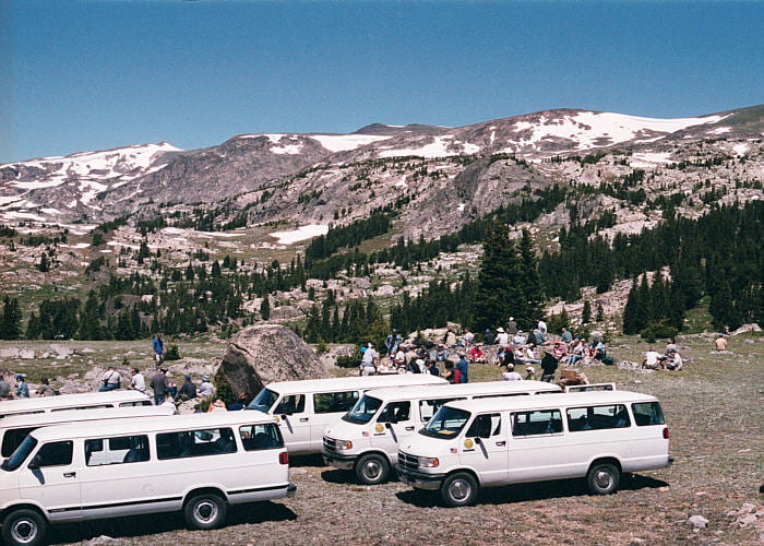
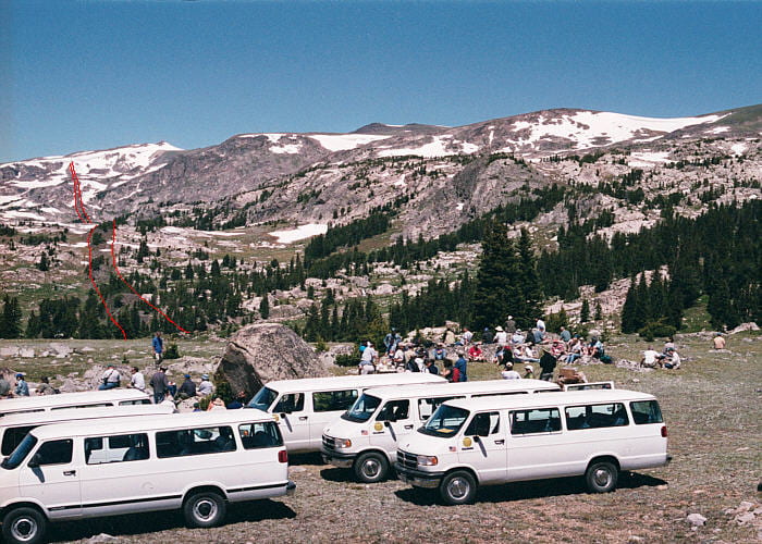
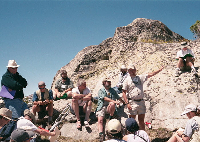
Stop 1. Granitization hypothesis outcrop

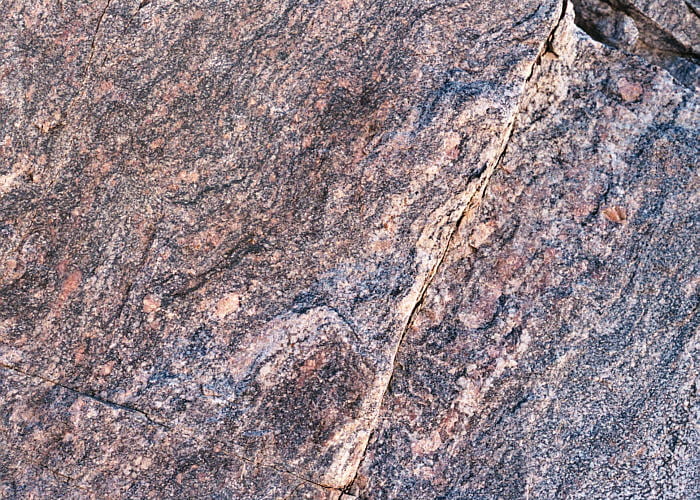
Northern part of the Beartooth Highway, not far below the plateau region. This nice overlook was the location of the granitization concept outcrop.
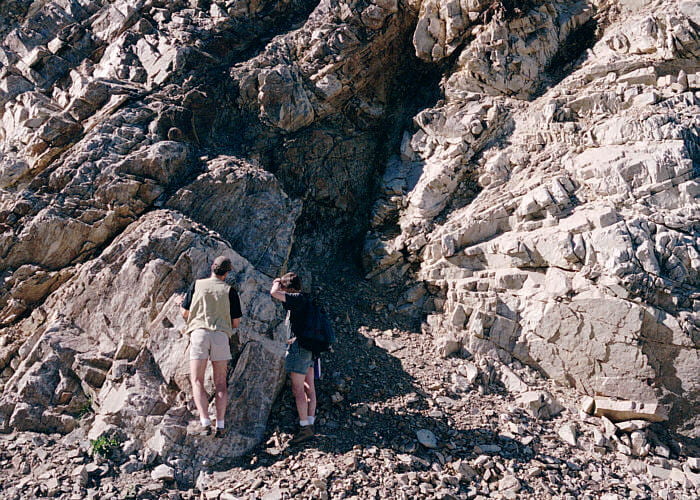
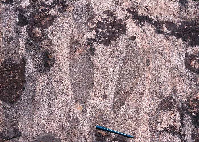
The rock on the right is a coarse-grained granite. The rock on the left is metamorphic, interbedded schist and quartzite. The contact between the metamorphic rock and granite is along a nearly vertical shear zone in the middle of the image (eroded and in dark shadow). The concept here is that granitizing fluids moved in from the right, converting the metamorphic rock (once sedimentary) into granite. The fluids were, in this concept, blocked here by the impermeable quartzite layers. It is important to recognize that the shear zone is a strike against this being a convincing example of granitization. The original contact relations between the granite and the metamorphic rocks are obscured by the fault.
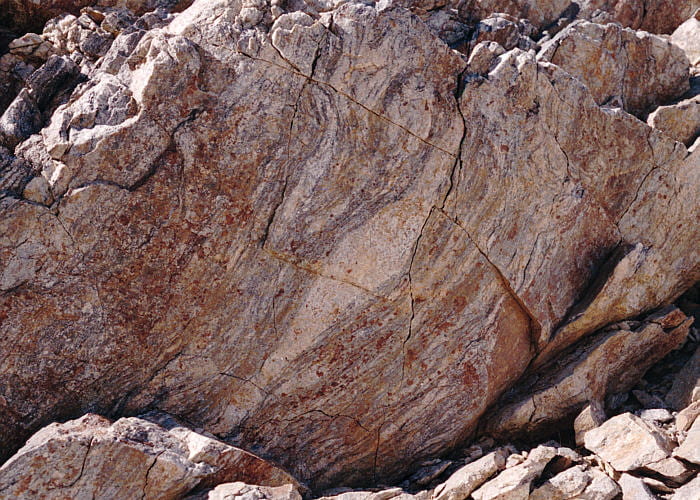
This is a close-up of some of the schist. It is strongly deformed and metamorphosed. Tight isoclinal folds are visible here, as are deformed pegmatites. In the granitization concept the pegmatites represent the initial influence of granitizing fluids moving parallel to the layering, transforming schist into granite. The modern alternative, of course, is that the schist was partially melted during metamorphism. The mineral assemblage in the schist is quartz–feldspar–biotite–sillimanite–garnet ± cordierite.
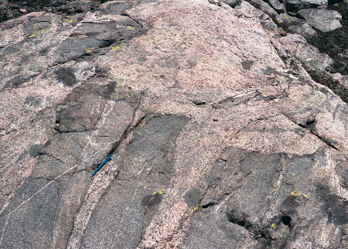
Close-up of one of the quartzite layers, flanked by schist that is visible to the upper-left and lower-right. Another strike against this being a convincing example of granitization is that the quartzites, hypothetically blocking the granitizing fluids, are discontinuous and therefore would not form a continuous barrier. Also, the schists on both sides of the quartzite layers look pretty much the same.
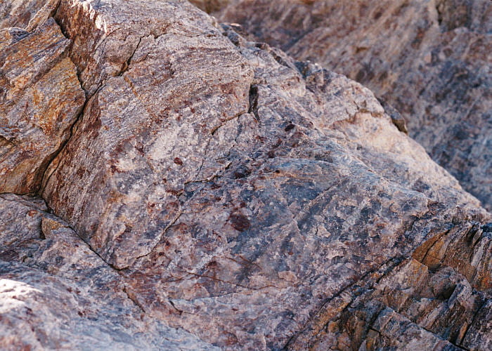
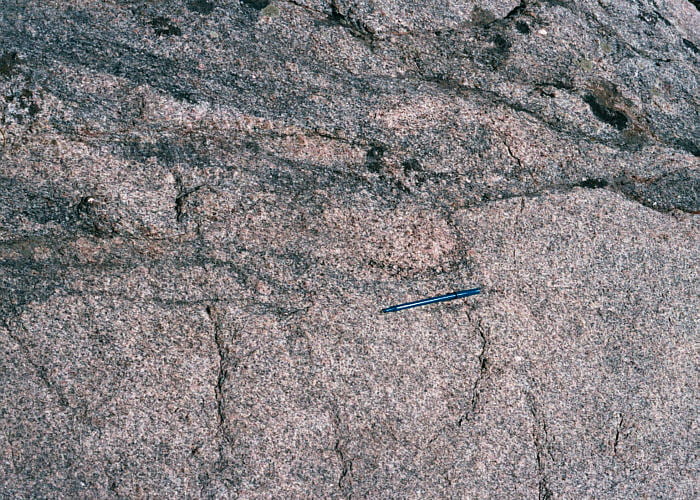
The granite on the other (right) side of the shear zone, near the shear zone. The rock is gneissic, layered and folded, obviously deformed. This texture was interpreted in the granitization concept to be layering left over from the original sedimentary/metamorphic rock, though it is clearly a deformational fabric.
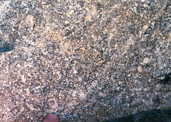
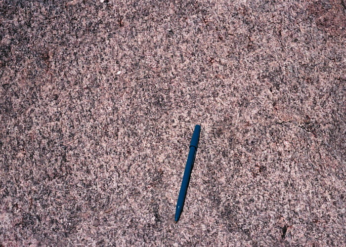
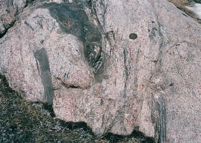
The same granite several meters farther away from the shear zone (again, to the right). Here the granite is essentially undeformed, and euhedral phenocrysts of feldspar are visible along with abundant quartz. The granitization hypothesis envisioned the continuous petrogenetic sequence for this outcrop: metamorphic rock, partially granitized metamorphic rock, granitized metamorphic rock with relict layering, homogeneous granite. The modern model envisions a generally discontinuous petrogenetic sequence for this outcrop: unmelted metamorphic rock to partially melted metamorphic rock on the left side of the shear zone. On the right side, magmatic liquid intruded, forming the granite. Later, ductile deformation produced the shear zone and possibly the gneissic fabric in granite near it.
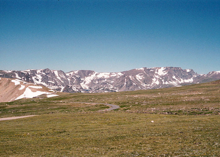
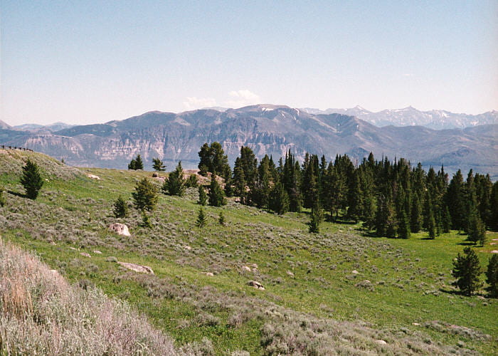
Stop 2. North side of the Beartooth summit plateau region
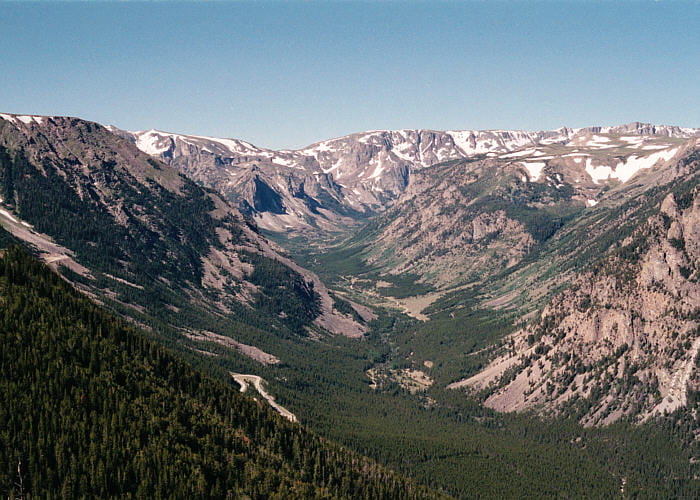
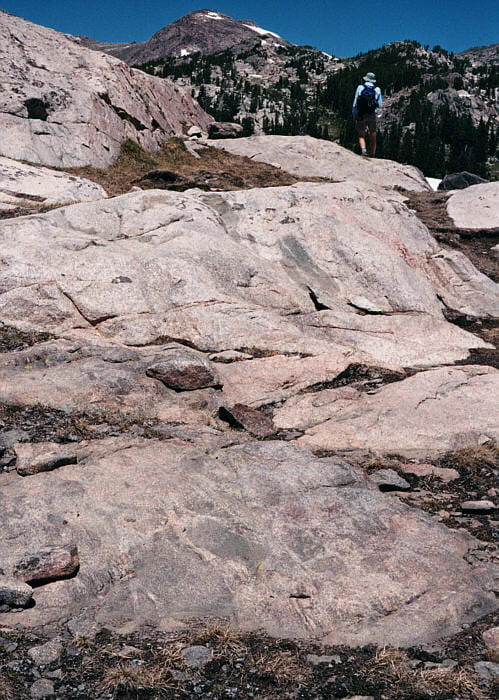
This is a view southward, up a beautiful U-shaped glacial valley carved into the north side of the Beartooth Mountains, with a little hanging valley to the right. This and the next few photos were taken at a little parking area at one of the hairpin turns on this part of the highway.
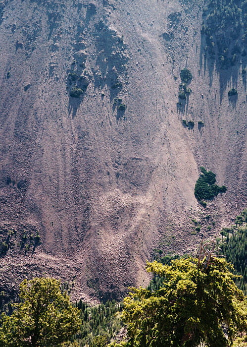
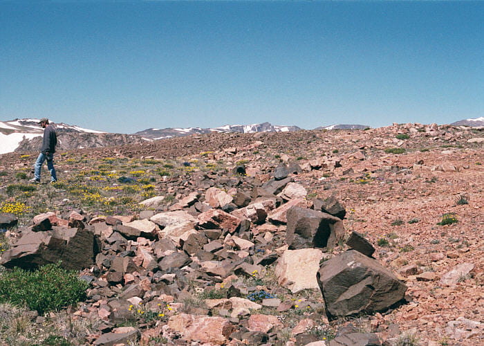
Talus slope with a little rock glacier at the base, visible on the east side of the overlook.

Some of the characters on the field trip, with the Beartooth Mountain tablelands in the distance. This is, or at least is close to, the Cambrian erosion surface onto which a considerable thickness of sedimentary rocks were once present. These rocks have mostly been eroded away, following Paleogene uplift of the Beartooth Range.
Stop 3. South side of the Beartooth summit plateau region
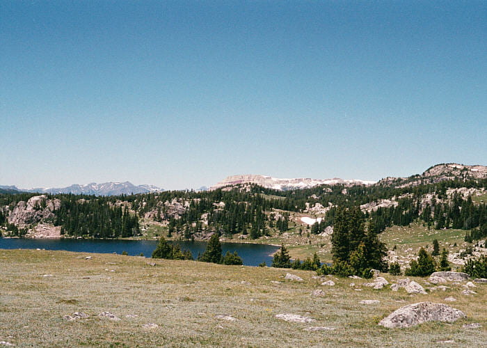
This next set of images is from the southern side of the plateau on the Beartooth Highway. The location is where the highway crosses the Christmas Lake dike.

View to the south of a lovely broad U-shaped valley with a stream and swamps along its center. View is to the south, toward Yellowstone National Park.

View to the southeast. The peak in the center distance is Heart Mountain, made of Paleozoic sedimentary rocks which have been emplaced in their current location along the famous but controversial (still?) Heart Mountain detachment fault.
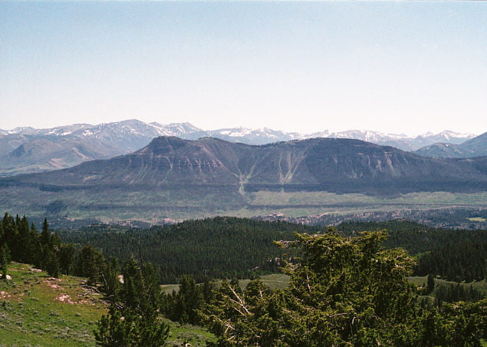
View of the Beartooth Mountains, looking to the west, across the table lands.
North edge of the Christmas Lake dike, one member of an extensive Proterozoic dike swarm exposed in the Beartooths and elsewhere. This is the approximate location of the northeastern (right) dike margin, better seen in the distance as the contact between the dark brown rock (left) and lighter rock (right). It’s a pretty big dike.
Close-up of the interior of this tholeiitic basalt dike. Light-colored plagioclase, black pyroxenes, and metallic magnetite are visible. This has a huge amount of magnetite, and looks like ferrobasalt.
I saw another dike like this, way to the south, on the east side of the Front Range in Colorado, along the highway just west of Estes Park and east of the Continental Divide. I wonder if it’s part of the same swarm.
Stop 4. Lunch! and also a granite mapping project
Lunch was near Long Lake on the Beartooth Highway, on the south side of the Beartooth Plateau. It’s a region of Archean granites and related rocks, cut by more dikes. The dominant rock seen here is the Late Archean Long Lake Granite, which cuts and includes more mafic rocks.
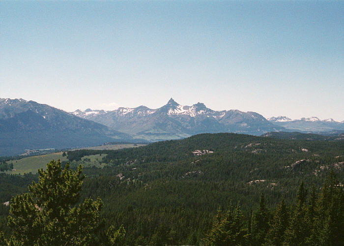
View approximately south. The layered, flat-topped peak in the distance is Beartooth Butte. It’s made of Paleozoic sediments that unconformably overly the Archean granites and gneisses.
Our lunch stop with the granites and gneisses in the background. Click on the arrows to see the dike path.
Our main task at this site was to map a ~150 m square region in granitoid rocks. There were several different broad classes of rock at this site. This is supposed to be what students would do at this site. I hope they had more time that we did. I, at least, didn’t finish my map.
This first is a homogeneous, light-pink biotite granite with weak foliation.
Here’s a contact between the light-colored homogeneous rock (lower half) and a much less homogeneous, generally darker rock (upper half). The less homogeneous rock includes a matrix that is somewhat more biotite-rich than the light homogenous rock, and contains numerous darker inclusions (xenoliths or autoliths).
Another view of the darker rock with biotite granite matrix and abundant dioritic inclusions.
The darker granitic matrix rock, with larger, more blocky dioritic inclusions, and pegmatites. This is a complex outcrop with more than one generation of granite and pegmatite emplacement.
Another example of the inclusion-rich darker granite, with pegmatite. The black, irregular inclusion is amphibolite.
The darker granite matrix rock with abundant mafic inclusions is in the near ground, with the more homogeneous, lighter colored granite near the top and far right. My impression from this mapping exercise is that this area is crossed by several sub-parallel, wide, dike-like bodies of granite, emplaced at different times and carrying different quantities of inclusions. My quick examination of the outcrops seems to indicate multiple episodes of granite emplacement.
Discussion of the outcrop and some of its possible interpretations. Emplacement pressure for these rocks was said to have been ~6 kbar (~20 km), where the intrusive rocks might remain mushy for awhile.
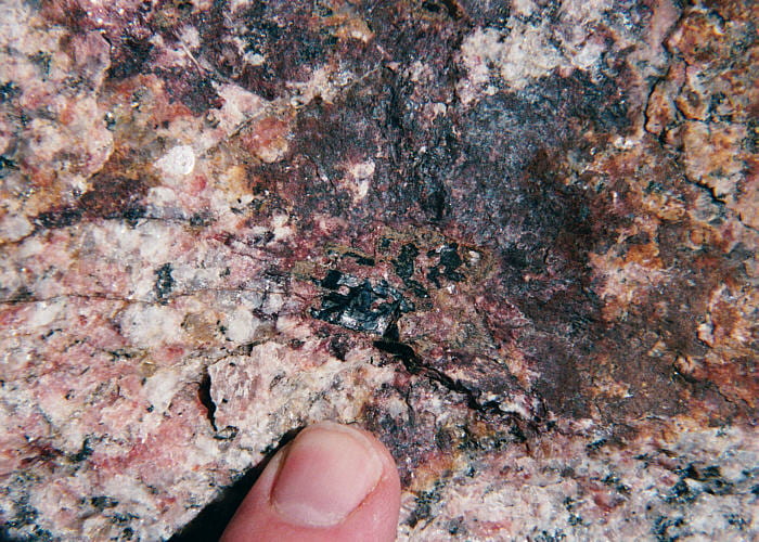
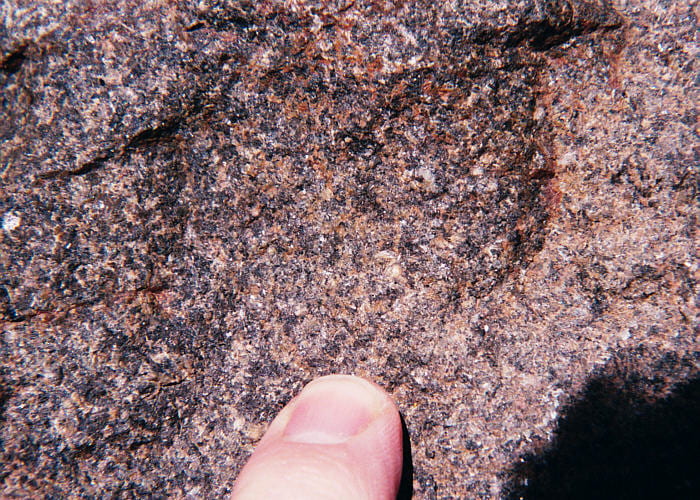
Large black allanite grains in granite pegmatite, exposed in blocks adjacent to the road, at the same stop as lunch and the granite mapping project. Notice the fractures radiating from the allanite crystal, caused by swelling as radiation damage destroyed the allanite crystal lattice.
Stop 5. Overlook, above Clark’s Fork Canyon
These last images are from a scenic overlook just off the Beartooth Highway, as it descends southward into Clark’s Fork Canyon.
The forested area in the near ground is mostly Precambrian gneiss and granite. Across the valley, most of the topography is made of the Absaroka Volcanics. The pointy mountain in the center is Pilot Peak, and the one to its right is Index Peak.
Looking almost due south into Clark’s Creek Canyon, down a nearly dip slope on the Cambrian unconformity where Precambrian rock dives beneath sedimentary and volcanic cover of Cambrian and younger age. The layered rocks on the opposite side of the canyon are Paleozoic sediments, above which are Eocene Absaroka Volcanics. The prominent layer halfway up the slope across the valley is the Ordovician Bighorn Dolomite. Immediately above the Bighorn Dolomite is the Heart Mountain detachment fault.
Looking southeast across Clarks Fork Canyon. The layered rocks in the distance are mostly Absaroka Volcanics, with Paleozoic sediments underneath. As above, the rocks in the near ground are Precambrian.
References and suggested readings
Mueller, P.A., Locke, W.W., and Wooden, J.L., 1987, A study in contrasts: Archean and quaternary geology of the Beartooth Highway, Montana and Wyoming. Geological Society of America Centennial Field Guide, Rocky Mountain Section, p. 75-78.
Pierce, W.G., 1987, Heart Mountain detachment fault and clastic dikes of fault breccia, and Heart Mountain break-away fault, Wyoming and Montana. Geological Society of America Centennial Field Guide, Rocky Mountain Section, p. 147-154.