The Stillwater Complex is a large fragment of a once-enormous ~2710 Ma ultramafic–mafic layered intrusion. It is exposed on the north flank of the Beartooth Mountains in Montana, a large Laramide (Paleogene) uplift. Stillwater layering is complex, in contrast to the comparatively simple layering of the Skaergaard Intrusion in Greenland. In the Stillwater, layering complexities are indicative of multiple processes operating within a vertically expanding (or laterally extending) magma chamber: injection of different magma batches of different compositions, magma mixing, double diffusive mixing, crystal fractionation, liquid unmixing, and doubtless others. The exposed part of the Stillwater Complex is 47 km long and up to 8 km wide. Its basal (southwestern and high elevation) contact is more or less intrusive, with substantial contact metamorphism. Its top is partly faulted out, and partly eroded away and buried under an unconformity. The top of the intrusion is therefore not exposed and may no longer exist. The ends of the elongate map pattern of the complex show that the layers are truncated, indicating that the intrusion was originally more extensive along strike. Layering dips at ~60° to the northeast. NOTE: Access to all parts of this field trip area are by permission of the landholders.
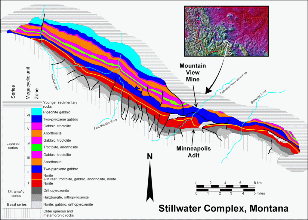
Simplified geologic map of the Stillwater Complex, after Todd et al., 1982. The Stillwater River is to the northeast of and parallel to the complex, so uphill is to the southwest. The units dip ~60° to the northeast.

Simplified stratigraphic columns of the Stillwater Complex, after McCallum et al. (1980) and Todd et al. (1982). Though there are different interpretations on what to call the layers and how to group them, there is clearly considerable complexity with repeated units of similar lithology. These columns do not come close to illustrating the extremely complex small–scale stratigraphy.
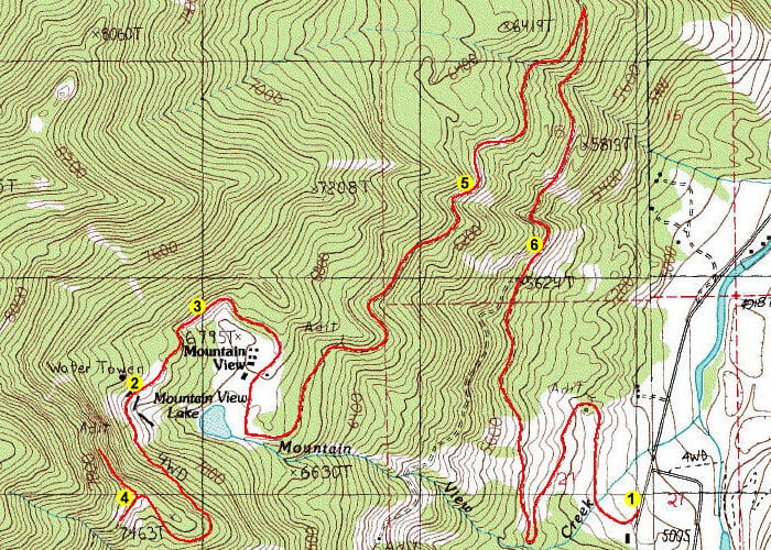
Travel route on mine access roads. Again, this is private land and access must be requested in advance.
Stop 1. Parking lot and roads
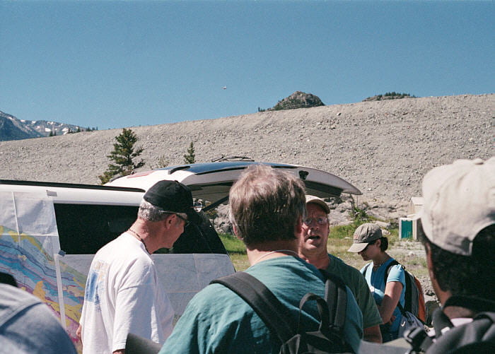
For this trip we were met by I.S. McCallum (black hat) who led the trip, with help from other trip leaders, which included a grad student. The embankment in the background is a dam for a tailings pond for the modern J-M reef platinum group metal mining operations, also seen in photos below. The tiny, odd spot in the sky is a helicopter, apparently related to a visit to the mine this day by the Montana Governor.
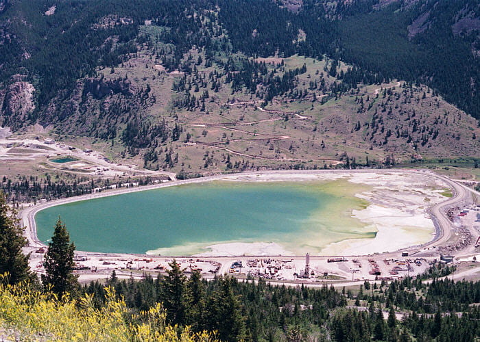
Tailings pond for the mining operations. At the time of the trip, mining was strictly for platinum group metals.

Some of the coarse debris from mining operations is put in mounds, seen at the foot of the slope on the other side of the valley.
Stop 2. Mountain View Mine
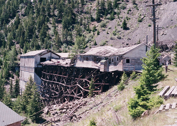
This is the abandoned Mountain View chromite mine that was worked through WW-II until about 1960, along with the Mouat Chrome mine described below. This photo shows abandoned buildings from the old mining operations.
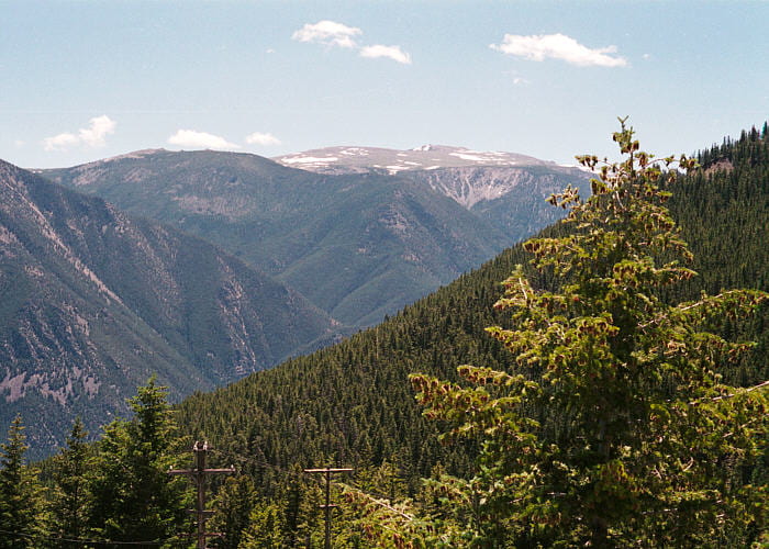
View across the Stillwater Valley to the tablelands on the top of the Beartooths, to the NE of the Stillwater River.
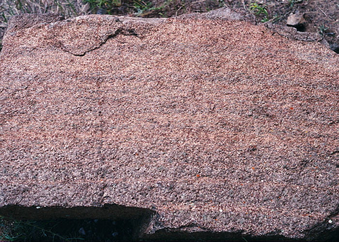
Diffusely layered cumulate orthopyroxenite, in blocks just above the Mountain View Mine.
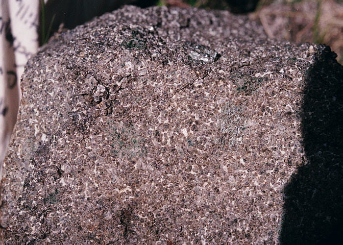
Cumulate orthopyroxenite, with intracumulus plagioclase (small white grains) and poikilitic augite (large dark-green patches, with OPX inclusions).
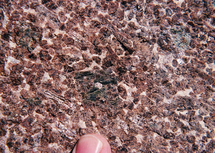
Close-up of cumulate orthopyroxenite. Cumulus orthopyroxene grains are brown, intracumulus plagioclase crystals are white, and the large, poikilitic dark-green crystals are intracumulus augite.
Stop 3. Ultramafic section-Lower Banded Series contact

Contact between the ‘ultramafic series’ and the overlying ‘lower banded series’ is exposed on the Mountain View Mine access road, ~0.5 km below the buildings shown above. The ultramafic rocks are brownish and are exposed on the left of this photo. The banded series, exposed to the right, contains abundant plagioclase, and is much lighter in color. The contact runs from the upper left to the lower right, through the image center.
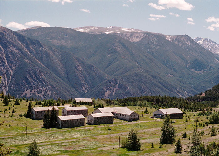
Housing camp for the old mining operations, as seen from near the contact.
Stop 4. Old Mouat Chrome Mine, near the abandoned No. 2 level waste dump
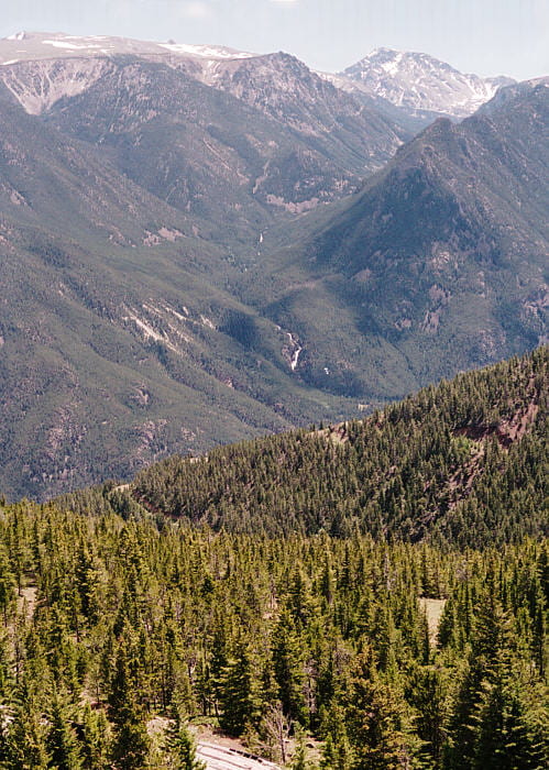
View northeast from the tailings pile.
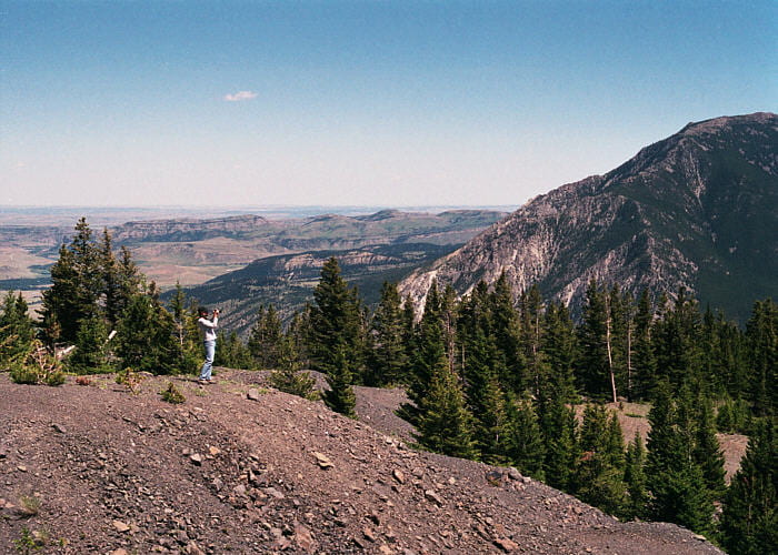
View northwest from the tailings pile, looking over sedimentary rocks beyond the Horseman thrust fault, at the front of the Beartooth massif.

Looking down at the Mountain View mine from just west of the Mouat Chrome Mine tailings pile.
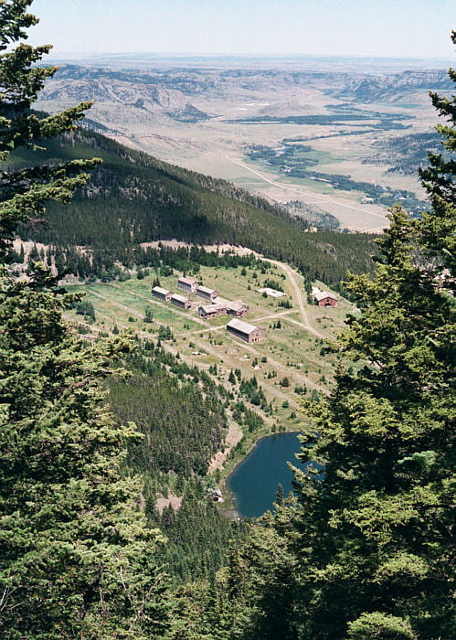
View of the Mountain View Mine camp, taken from an overlook just west of the Mouat Chrome Mine tailings pile. From this point we walked along a rugged traverse through the woods through parts of three steeply–dipping ultramafic cyclic units. The cyclic units here are ~10 m thick, and there are ~20 of them. Each cyclic unit has the mineralogical sequence, from base to top, shown in the table below. The potentially economic chromitite deposits are the lower olivine–chromite cumulates. How these cumulates came to be was a point of much discussion during the trip.
| Position | Lithology | Cumulus minerals | Intracumulus minerals |
|---|---|---|---|
| Top | Orthopyroxenite | Opx | Augite + plagioclase ± quartz |
| Middle | Granular harzburgite | Olivine + Opx + chromite | Augite + plagioclase ± biotite, ampibole |
| Bottom | Poikilitic harzbergite ± chromitite | Olivine + chromite | Opx + augite + plagiovlase ± biotite, amphibole |
| Modified from a table in the Teaching Petrology Workshop field trip guide. | |||
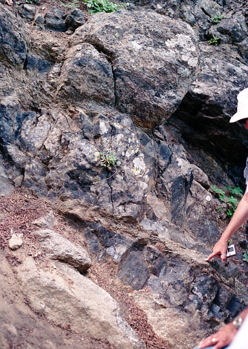
This shows the base of chromitite G, in the ultramafic section. This chromitite unit is actually composed of several thin layers over ~3 m of section, with intervening olivine–chromite cumulates. Individual layers may be only one crystal thick, which is remarkable. Chromite layers can vary in thickness, terminate, and bifurcate. Chromite can also occur in discontinuous lumps. Chromitite G and the overlying H chromitite were mined at the Mouat Chrome and Mountain View mines during WW-II to 1960 as a source for chromium for stainless and high-strength steels. Though not currently mined, chromitites G and H contain ~80% of the chromium metal reserves in the western hemisphere.
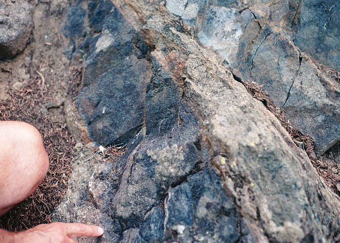
Near the knee is the lowermost of two thick chromite-rich layers in the G chromitite. The next layer up is in the upper-right corner.
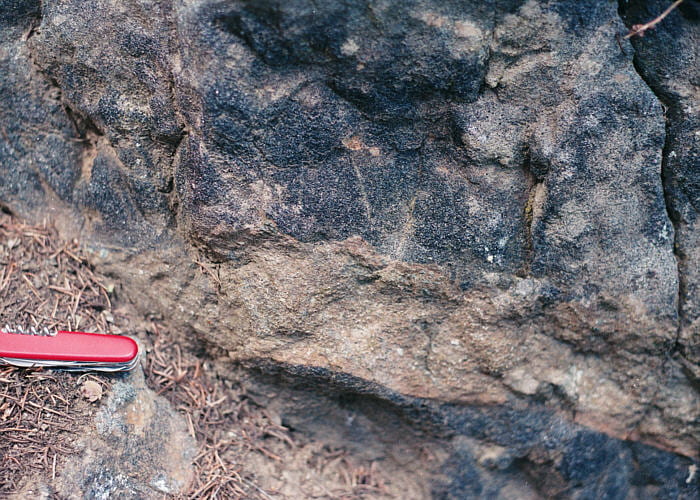
Peculiar cuspate structures at the base of one of the lower chromite layers. Soft sediment deformation features?
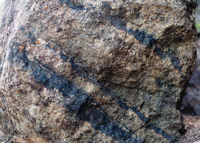
Thin chromitites in the G chromite layer.
Stop 5. Modally layered section

View of the tailings pond, the coarse mine waste pile, and the processing plant. The river is the Stillwater.
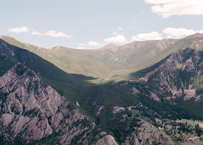
Hanging valley across the Stillwater River.
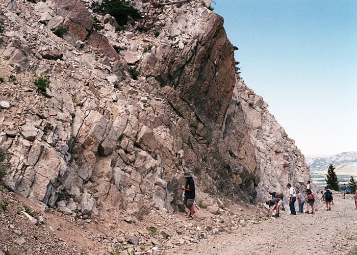
Modally layered section within the “lower banded series.” Light-colored rocks to the left are gabbroic anorthosite, dark rock in the center is troctolitic gabbro, and the distant light-colored rock is anorthosite. Mineral abundance variations can actually be on a very fine scale and are considerably more complex than this caption indicates.
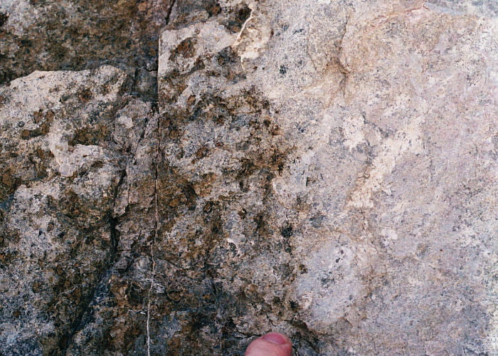
Contact between the anorthosite (right) and the troctolitic gabbro (left).
Stop 6. “Inch-scale layering” in anorthosite
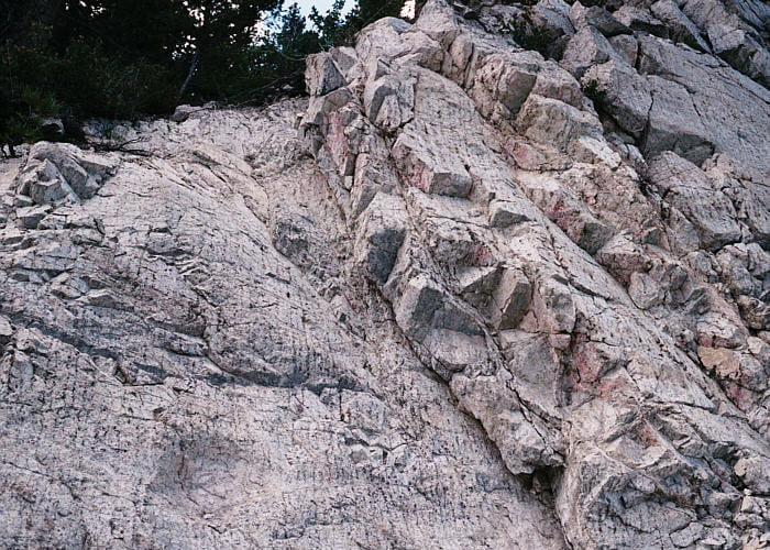
Roadcut with the famous “inch-scale layering” in anorthositie in the lower banded series.
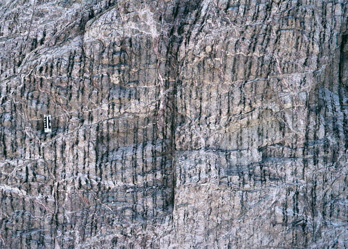
Closer view of the strikingly paired couplets of thin and thick anorthosite layers with intervening dark pyroxene.
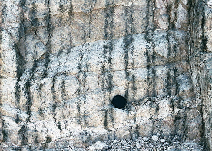
Closer view of the “inch-scale layering” with anorthosite-pyroxene couplets.

Closest view of the inch-scale layering and couplets. I really don’t understand these things.
And finally, dinner in the evening

Field trip party, having dinner and relaxing on the porch of the YBRA Field Station, near Red Lodge, Montana.
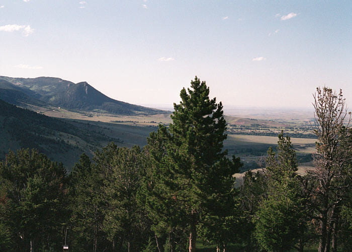
View to the north from the YBRA Field Station porch. Notice the hogbacks on the distant ridge to the left.
References and suggested readings
Boudreau, A.E. and McCallum, I.S., 1986, Investigations of the Stillwater Complex; III, the Picket Pin Pt/Pd deposit. Economic Geology, v. 81, p. 1953-1975.
Czamanske, G.K. and Bohlen, S.R., 1988, The Stillwater Complex and its anorthosites; an accident of magmatic underplating? American Mineralogist, v. 75, p. 37-45.
Haskin, L.A. and Salpas, P.A., 1992, Genesis of compositional characteristics of Stillwater AN-I and AN-II thick anorthosite units. Geochimica et Cosmochimica Acta, v. 56, p. 1187-1212.
Helz, R.T., 1995, The Stillwater Complex, Montana: a subvolcanic magma chamber? American Mineralogist, v. 80, p. 1343-1346.
Irvine, T.N.; Sharpe, M.R., 1982, Source-rock compositions and depths of origin of Bushveld and Stillwater magmas. Carnegie Institution of Washington Yearbook, v. 81, p. 294-303.
Keith, D.W., Todd, S.G., and Irvine, T.N., 1982, Setting and compositions of the J-M platinum-palladium reef and other sulfide zones in the banded series of the Stillwater Complex.. Carnegie Institution of Washington Yearbook, v. 81, p. 281-286 (and related articles through p. 303).
Lambert, D.D. and Simmons, E.C., 1987, Magma evolution in the Stillwater Complex, Montana; I, Rare-earth element evidence for the formation of the Ultramafic Series. American Journal of Science, v. 287, p. 1-32.
Loferski, P.J., Lipin, B.R. and Cooper, R.W., 1990, Petrology of chromite-bearing rocks from the lowermost cyclic units in the Stillwater Complex, Montana. U.S. Geological Survey Bulletin 1674-E, p. E1-E28.
Longhi, J.; Wooden, J. L.; Coppinger, K. D., 1983, The petrology of high-Mg dikes from the Beartooth Mountains, Montana; a search for the parent magma of the Stillwater Complex. Journal of Geophysical Research B, v. 88 Supplement, p. 53-69.
McCallum, I.S., et al., 1980, Investigations of the Stillwater Complex Part I. Stratigraphy and structure of the banded zone. American Journal of Science, v. 280-A, p. 59-87.
Page, N.J., 1979, Stillwater Complex, Montana. Structure, mineralogy and petrology of the banded zone with emphasis on the occurrence of sulfides. U.S. Geological Survey Professional Paper 103, 69 p.
Raedeke, L.D.; McCallum, I.S., 1984, Investigations in the Stillwater Complex; Part II, Petrology and petrogenesis of the ultramafic series. Journal of Petrology, v. 25, p. 395-420.
Todd, S.G., et.al., 1982, The J-M platinum-palladium reef in the Stillwater Complex, Montana. I. Stratigraphy and petrology. Economic Geology, v. 77, p. 1454-1480.
