Looking west across Hjemsted Bay, at approximately the point where cumulus apatite comes onto the liquidus, near the transition from UZa to UZb (apatite-in is somewhat above the UZa-UZb contact). In terms of climate this region is transitional between temperate and high arctic regions. Permafrost occurs on all slopes in areas not much farther north than Skaergaard, and regions with no permafrost occur not too far to the south (recall that this is a partially maritime climate). The Skaergaard area has permafrost on the north flanks of mountains and outcrops that never get substantial direct sunlight.

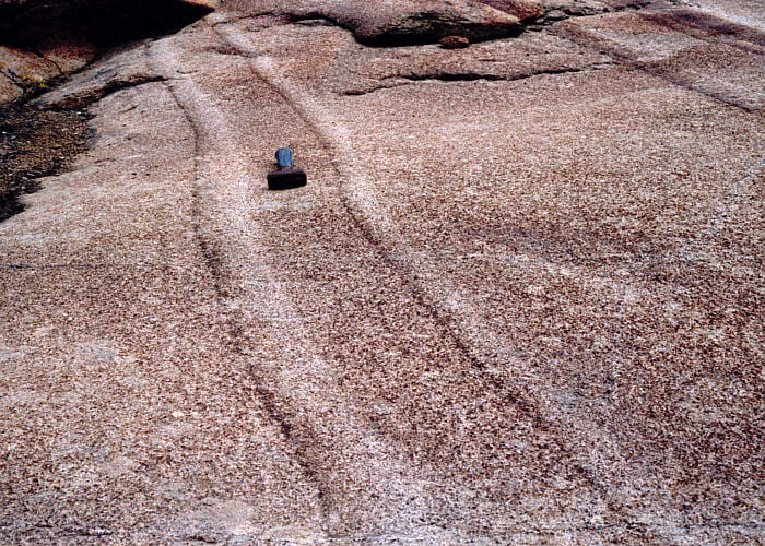
Looking southeast down the axis of large trough structure G in UZa (trough labels follow McBirney, 1989). U-shaped beds define the trough, and these were deposited contemporaneously with higher-elevation, between-trough ridges of weakly layered rock. The troughs were probably quasi-stable channels that were swept continuously or episodically by dense, cllo, crystal-rich currents. The dark layers are rich in olivine, pyroxene, and Fe-Ti oxides, whereas the light-brown regions are richer in plagioclase. Troughs like these are found only in the upper part of UZa and lower part of LZb, and are roughly radial from the inferred pluton center.

More distant view of trough G, showing how the rocks in the ridge region to either side of the trough are only weakly layered. Note that, whereas the ridge rocks are made of medium brown rock, the trough has alternating dark brown and very light layers. Though not quantitative, this suggests that the overall mineral mode of the trough region is similar to that of the adjacent ridge regions.

Close-up of some of the pervasive subsolidus fractures that are filled with amphibole, and other minerals that were deposited by fluids after the pluton was solid. These cracks occur in many different azimuths, though most are nearly vertical.

“Christmas tree” anorthositic replacement features, confined to layer bedding planes. The fluids (probably plagioclase-saturated, H2O-rich silicate liquid) may have been confined to the bedding planes by particularly impermeable layers.

Extensive “Christmas tree” anorthositic replacement features on a bedding surface. These typically occur at the leucocratic top of a graded bed.

Photo of mafic Christmas tree structures in the same bedding plane as anorthositic Christmas tree structures, visible near the top of the slope. The anorthositic structures are the same as those in the photo immediately above, but here photographed from below. In the near ground, the felsic dendritic structures are replaced by mafic mineral dendritic structures.

The next several pictures are of Trough F. The view here is east, across a gully toward Trough F, with planar graded beds visible near the gully floor to the lower left, and the trough developing just above the planar beds and extending to the upper center.

Close-up view of the planar graded beds seen in the photo above, with characteristic dark bottoms and light tops. These beds are widely spaced with homogeneous rock in between that is like the ridge rock between troughs.

Microrhythmic layering at the base of Trough F, just above the planar graded beds seen in the two photos above. Microrhythmic layering differs from the graded bedding in being generally more regular in layer spacing and thickness, generally being associated with the bases of troughs (or xenolith or autolith blocks), and not having sharp boundaries between dark or light layers.

Close-up view of the microrhythmic layering in the photo above. Oxides and plagioclase are easy to discern, and the olivine and pyroxenes are both rusty patches.

Impressive graded beds in the middle part of Trough F, showing layer thinning at the trough margins where the trough merges with intervening ridge rock. The odd-looking square patch, to the left of center, represents a sample site for Pt-group elements.

Graded beds near the base of Trough I. Notice that the average graded bed mineral mode appears at least superficially to have the same mode as the intervening homogeneous rock.

View to the south across Skaergaard Bay. Ship is visible on the left.

Looking east down Trough I, showing graded, oxide-rich trough beds in the middle level of the trough. Note how the trough walls were quite steep (~45°), where the trough layers grade into the nearly homogeneous intervening ridge rock.

Microrhythmic layers (to the left of the jug) in the lower part of Trough I, that are truncated by later beds.

Central zone of Trough I, in which the layers are very oxide-rich and curve steeply, quickly thinning out toward the adjacent ridges. These central, oxide-rich zones are typically 1 to 2 m across. They commonly occur within much broader and more shallowly curved beds, some of which are also quite oxide-rich. The central portion is suggestive of a narrow, dense undercurrent carrying, or at least depositing, very oxide-rich cumulates as part of broader and generally less oxide-rich currents.

View of trough E, looking northeast. The curved trough layers are very wide toward the trough base and narrow upward (at least in obvious layers). This photo was taken from near the middle part of Trough F.

Closer view of the upper part of Trough E, seen in the photo immediately above.

Irregular anorthositic replacement rock, just south of Trough E, and just west of the autolith in the photo below.

Gabbroic anorthosite autolith, just south of the lower part of Trough E (just visible to the upper-left). These autoliths are thought to have broken off the partly solidified Skaergaard roof zone (Upper Border Series).

Looking east along the path of the plagioclase porphyry dike, which is one of the oldest cutting the Skaergaard Homestead area. This dike has contact-parallel layering, visible near the margin, and a chilled margin at the contact (not actually visible here). The chilled margin has few plagioclase phenocrysts, suggesting that the first batch of magma through the dike didn’t have as many phenocrysts as later magma.

This is a close-up of the plagioclase porphyry dike, above, showing the unusual density of plagioclase phenocrysts. Many phenocrysts are acicular, and are grouped in radiating bunches.


The contact between light-colored UZa rock to the right and darker UZb rock to the left. The designation change from UZa to UZb is determined by the appearance of cumulus apatite in UZb. At least here this seems to occur with a decrease in the amount of feldspar in the mode.

Thick, somewhat diffuse graded beds in UZa. Beds top to the right. I think this is the side of a ridge and so represents rock transitional between trough and ridge rocks.

Medium-size leucotroctolite autolith (light-colored patch) in UZa rocks near trough C.

Stunning graded beds between homogeneous layers, below Trough B.

Close-up of one of the graded beds in the photo immediately above. Unfortunately, the bed bottom is not too distinct here, though the light-colored top is sharp.

Close-up of the contact between the light top of one bed and dark bottom of another. There is no mineralogical change, only a change in mineral proportions. The contact zone width is about 1 crystal diameter of ~4 mm.

View to the north toward Wager’s Top, the highest peak visible at 1277 m. From left to right there is Hænge Glacier, Bjørneskinds Glacier, and Forbindelses Glacier. The Triple group is barely visible, just below the summit of Wager’s Top.

Looking south across Skaergaard Bay. The peculiar layering visible in the lower-left may be related to a nearby autolith block, a part of which is visible as light-colored rock to the left of the person.

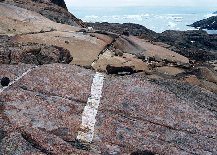
Two transgressive granophyre dikes. These dikes are transgressive (cut other rocks), and are made of a fine-grained granitic rock (granophyre) made mostly of quartz, alkali feldspar, plagioclase, brown amphibole, and biotite. Isotope systematics strongly suggest that this material is partial melt from the Archean gneiss surrounding the Skaergaard pluton. That makes it distinct from granophyre associated with some mafic pegmatites within the Skaergaard.

View to the north across the eastern part of Uttental Sund. The northwest contact between the Skaergaard and Archean gneiss is visible in the upper left. The flat region in the distance is the Uttental Plateau. Mountains in the far distance are on the north side of Watkins Fjord.

Mafic pegmatite replacement bodies. Pluton top is to to the upper right.

Close-up of part of the mafic pegmatite seen in the photo immediately above. White and gray are plagioclase, black is pyroxene and magnetite, and rusty patches are olivine. These pegmatites are frequently associated with anorthositic replacement features.

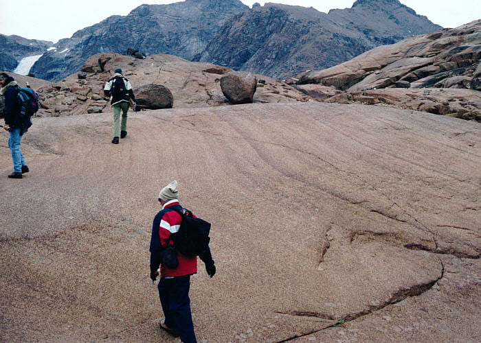
An unusual, very sharp, steep-walled trough below trough B (?). My impression is that it’s an extensional fracture. Some of the sharp features on the right of the trough look like small faults. The subhorizontal lines are glacial striations, not layering.

Irregular gabbroic anorthosite replacement rock, just west of Trough C.

Looking south along the “campsite composite dike”. This is one of the oldest dikes in the Skaergaard, and contains abundant, centimeter to meter scale xenoliths. Those xenoliths contain plagioclase and mafic minerals that are more An-rich and Mg-rich, respectively, than any found in the exposed Layered Series. They have been interpreted as part of the “hidden zone” of layered Skaergaard rocks below the current erosion level. If this is correct, then geochemical modeling requires a very large hidden zone, contradicting the most recent gravity models that suggest a very small hidden zone.

Nice graded beds with intervening homogeneous rock. Note the gabbroic anorthosite replacement rock along the tops of the two left-most beds.

Photo taken along strike, to the left, of the photo immediately above. Here you see stratabound mafic pegmatites that appear to be associated with anorthositic replacement material farther to the left.

Close-up of the mafic pegmatite visible in the photo above. Visible are white and gray plagioclase, brown pyroxene, black magnetite, and small quantities of very rusty olivine.
