Sea ice forms from freezing of sea water on the ocean surface. In the Skaergaard region, sea ice principally forms during the winter in fjords and other coastal waters. The weather in the winter is generally not cold enough for significant sea ice to form in the open ocean at this latitude, though it does not much farther north. Much of this northern sea ice is carried by currents southward to the southern tip of Greenland. Sea ice proper usually forms very flat, obviously thin, pancake-like layers that rarely stand more than a few tens of centimeters above the water line (~10 cm for each meter of ice thickness). Most of the sea ice has melted by early September, when our trip took place. Icebergs, in contrast, are blocks of ice calved off the ocean margins of glaciers. They are irregular in shape and are generally vastly larger and thicker than sea ice chunks. Though broken off bits of icebergs can be the size of sea ice chunks, they are almost always irregular and do not form the flat, pancake-like shapes of sea ice.

One of the many chunks of ice that we encountered while approaching the Skaergaard area. This piece is ~5 m long, and is probably a small bit of iceberg.

A small iceberg, with Tinden peak. in the background. The upper, southeastern part of the Skaergaard intrusion is the brownish area to the left of center.

Large numbers of small icebergs. The largest in the near ground is ~30 m across. This shows the eastern side of the entrance to Kangerlussuaq Bay. Notice how the two nearest icebergs have shelves just below the surface that extend out several meters. These make close approach to icebergs a delicate task.

The largest iceberg we got close to was this one, at ~600 m long, in Kangerlussuaq Bay. In contrast, our ship was only 66 m long. Since the average height of the iceberg above the water surface is ~40 m, the average total thickness of the iceberg is ~400 m. This iceberg remained the whole time in about the same place. Its deep keel may have caused it to become stranded in shallow water.

Iceberg in Kangerlussuak Bay. This might be the ~600 m long iceberg in the photo immediately above, but from a different angle.

Lots of icebergs and small bits of ice, looking southeast toward the mouth of the Kangerlussuaq Fjord. The largest iceberg in the near ground is ~50 m long.

Small icebergs and a little sea ice just southwest of the entrance to Uttental Sund. The blue iceberg is ~20 m long.

Blue iceberg just outside of Skaergaard Bay.

Another blue iceberg just outside of Skaergaard Bay.
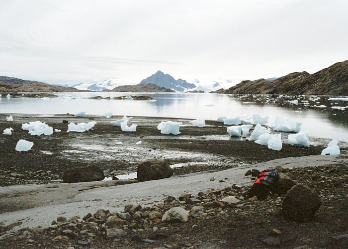
Sea ice chunks left stranded during low tide. The stranding surface is part of the outwash delta of Forbindelses Glacier. Uttental Sund is behind, and Kramer is Island to the right, and the Homestead area is to the left.

Stranded sea ice piece in the photo above.

View to the southwest across Skaergaard Bay and Kangerlussuaq Bay beyond. The ship is left of center, with many medium and small icebergs around.

Looking out across Kangerdlugssuaq Bay with plenty of icebergs and some sea ice. The very flat pieces on the right side are sea ice.

View of the ship and ice in Mikis Fjord. The largest piece of ice on the left is ~250 m long. The iceberg on the far right is about the length and height of the ship, but because it is solid ice, and wider than the ship, its mass is roughly a quarter million tons compared to the 2000 tons of our ship. It should be clear why ships should avoid colliding with icebergs.

Blue iceberg in Skaergaard Bay, seen over the top of one of the lifeboats.

Iceberg in Skaergaard Bay.

The three Zodiacs approaching shore, with nearby blue iceberg chunks. Ivnarmiut Island is in the distance.