This was just a half day trip. Though it was comparatively warm, the rain and such made the trip leaders decide that a full day was not a good idea. It was somewhat miserable, lunch would have been soggy, and hypothermia was a risk not to be taken lightly.
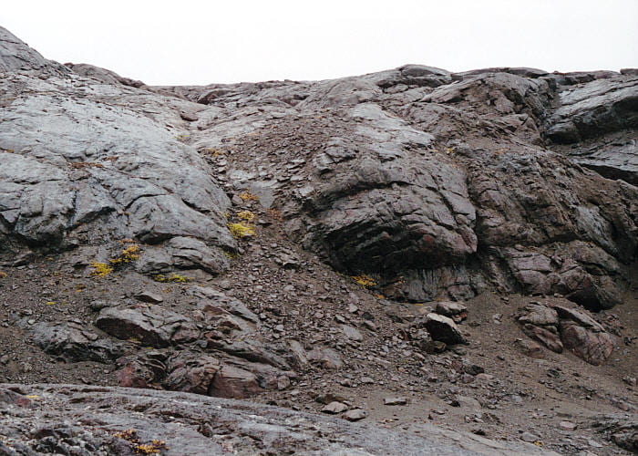
As you can see, the rocks were all wet. Here’s a photo of the Marginal Border Series, just above the landing place on southeastern Ivnarmiut Island, looking northwest. Barely visible, right of center, are layers in the MBS unit MZ* (?) dipping steeply down to the right.

Looking northeast toward Wager’s Top (hidden in clouds to the top-left) and Pukugagryggen. People are all dressed in raingear for obvious reasons, which at least added a bit of color to the photos.

So-called colliform layering is common in the MBS. It has convex-inward layers typically 0.5 to 2 m across, with intervening, outward pointing cusps. This shows some impressive colliform layering, where the layers are reasonably continuous and concentric. These are growth structures rather than erosional. Center of the pluton is to the left.

Thick right-dipping layers in the MBS, showing replacement pegmatites on the left and right. The pluton center is to the right. The colliform layers seen elsewhere are on the outcrop tops, so here we see the colliforms in longitudinal section. The colliform layers are not, therefore, shaped like stacked up egg shells or bumps, but are like long, nested pieces of celery, oriented vertically along the walls, and convex inward.

Looking east across the Homestead area on the other side of Uttental Sund, toward Basistoppen and Basis Glacier. Most of the Basistoppen circuit trip, from the start to the Douglas Plateau, is visible here. The sometimes-occupied Inuit settlement is barely visible in the lowland of the left midground.

The contact between LZc* (left) and LZb* (right), though it is not very clear due to the wet rocks and the people. LZc* is rather fine-grained, with few pegmatites in this area, whereas LZb* is quite coarse-grained, and contains abundant pegmatites. I’m not sure why that should be so.

Very nice colliform layering in LZb*. The center of the pluton is to the right.

Me on Ivnarmiut Island. Ah, to be young again.

Patch of perpendicular feldspar rock in the cusp part of some colliform layers. The feldspars are perpendicular to layering in the narrow cusp, causing the feldspars to crowd toward the center.

Another batch of perpendicular feldspar rock, a few meters south and one layer toward the pluton margin from that in the photo above. Not on a cusp.

An abandoned Inuit house foundation on the southern point of Ivnarmiut Island. The stone walls would have a down-pointing entryway, and skins covering the top. Now the rocks are somewhat jumbled, so the entryway wasn’t discernible.

Just on the other side of the abandoned house, is the western contact of the Skaergaard pluton. A few meters inside of the contact are numerous xenoliths of Cretaceous sediment and vesicular Tertiary basalt, trapped in the MBST. This photo shows a small contact metamorphosed sedimentary xenolith with a granofels interior and a partially melted and chemically modified margin. Note the black magnetite reaction rim on the surface of the granofels xenolith interior.
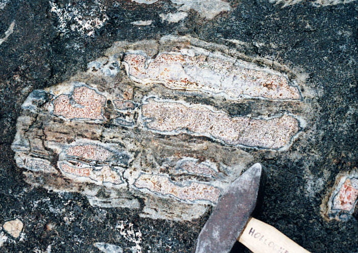
A somewhat larger xenolith than that in the photo above, with original sedimentary layering that has been differentially melted and reacted.

Close-up of granofels in the photo immediately above. Though difficult to tell in the dim light and rain, it looked like this rock contained cordierite, spinel, feldspar, and rutile. The larger brownish-green dots are spinel.

Composite gabbro block containing numerous sedimentary xenoliths, which was then broken off of somewhere and itself engulfed by gabbroic liquid.

A moderate-size basalt xenolith and several smaller ones, a few meters from the contact in MBST. Several of the xenoliths have amygdules (filled vesicles). The pluton-Archean gneiss contact is down in the water.
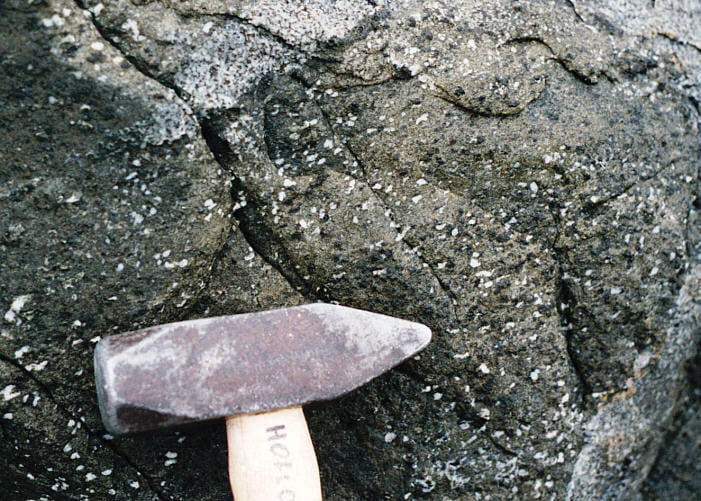
Amygdular basalt xenolith, in the xenolith flotilla shown in the photo above, entrapped in MBST gabbro.

View along the contact, Skaergaard to the right, Tertiary basalts to the left. In the far distance are Archean gneisses. The xenoliths in the photos above are just at the top of the cliff on the right.
The waves were quite strong, despite all the ice about. We were admonished not to fall in. Good idea.
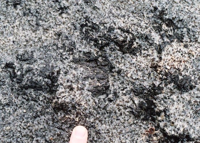
Large pyroxenes in wavy pyroxene rock ~10 m from the contact in MBST.

Center and to the right are steeply left-dipping layers of the MBS on the west side of the pluton. On the left is the transition to the Layered Series, where steeply left-dipping layers successively transition to more shallowly left-dipping layers. The MBS-LS transition is therefore quite sharp, at least here.
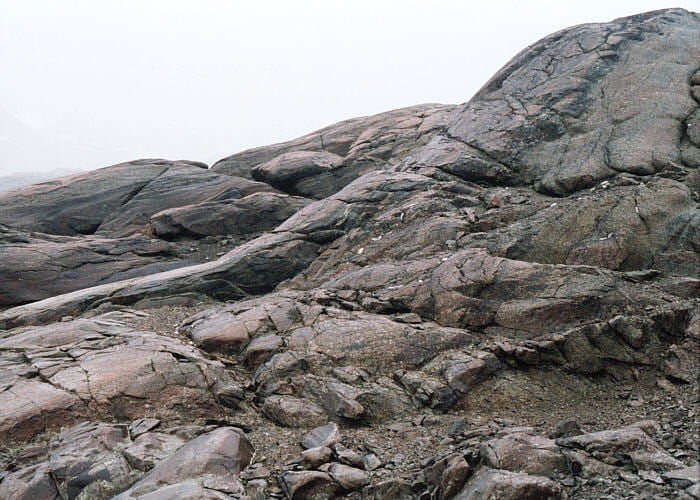
A more distant view of the region in the photo immediately above, with UZa* rocks of the Marginal Border Series on the right, dipping at ~70° to the left, and UZa rocks to the left dipping at ~20° to the left. The contact is in the middle of the photo and is quite sharp: layers ramp from one to the other over only a few meters.

Composite image of the contact between steeply dipping MBS (right, dipping at ~70° to the left), and rocks of the UZa (center and left, dipping at ~20° to the left).

Another perspective of the same contact region. Steeply dipping beds of the Marginal Border Series are on the wall ahead, and the more gently dipping beds, in the foreground and under the shovel, are in the shallow-dipping Layered Series. The curved surface making the transition between the foreground rocks and the steep wall is the transitional ramp.
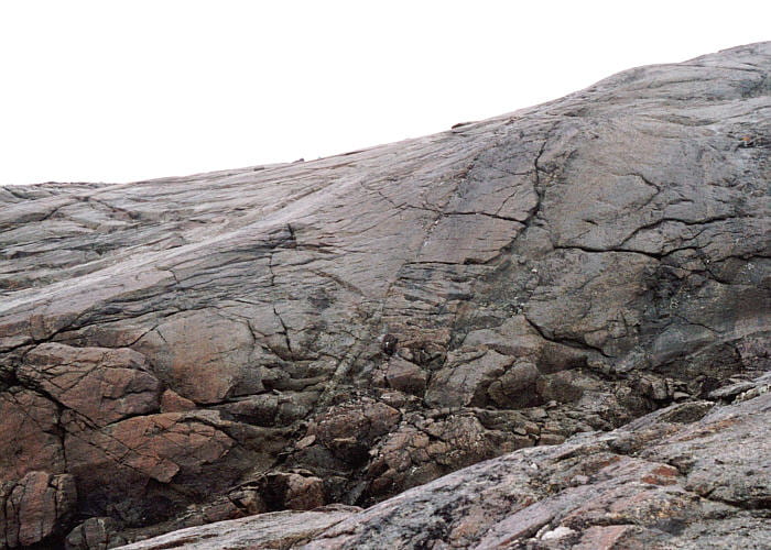
Another view, looking south, of the same contact between the Layered Series (left, dipping ~20° to the left) and the Marginal Border Series (right, dipping at ~70° to the left).

Composite of the Layered Series–Marginal Border Series contact area, seen in photos, above.
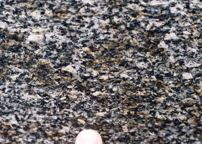
Close-up of the UZa rock in the Layered Series, just to the left of the Layered Series-Marginal Border Series contact in the photos above. The parallel alignment of the crystals is visible. The mineralogy is plagioclase, pyroxene, and oxides.
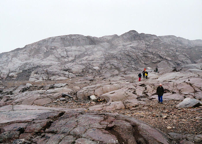
Looking west from near the Zodiac pickup point in the Layered Series, back toward the Marginal Border Series. Steep gray rocks from the center to the top, in the distance, are in the MBS, which seems more resistant to erosion here than the closer, brownish rocks of the Layered Series. The contact is at the break in slope just behind the distant orange person.
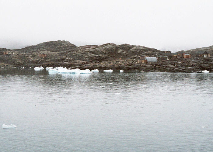
View of the occasionally-occupied Inuit settlement on Skaergaard Peninsula. Looking southwest from the strait between Skaergaard Peninsula and Ivnarmiut.

Zodiacs coming to pick us up from Ivnarmiut.

Climbing into the Zodiacs, with the Russian pilot holding the boat.
