Keck Geology Consortium Field Trip, 2008
Northern Connecticut River Valley, Massachusetts
This trip was to see Triassic and Jurassic red beds, peculiar red bed sedimentary structures, the Deerfield Diabase lava flow, glacial landforms, and glacial deposits.
Stop 1
Mt. Sugarloaf, a steep hill in the center of the valley, made of Triassic fluvial conglomerate and sandstone.
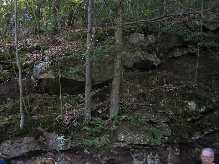
Walking the roadway to the top of Mt. Sugarloaf, Sunderland.
This photo shows a small conglomerate-filled paleo-stream channel, cut into somewhat finer-grained conglomerate below it.
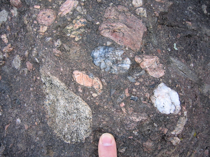
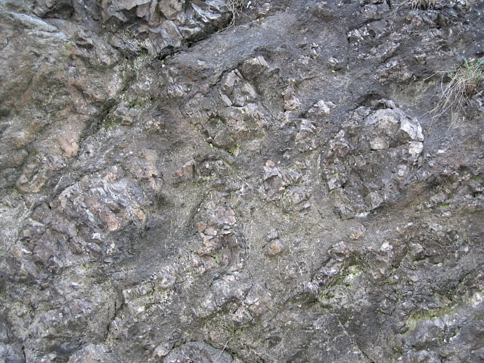
Coarse conglomerate, taken of a glacially-polished pavement outcrop at the Mt. Sugarloaf summit. Cobbles and pebbles include vein quartz, granite, gneiss, shist, and phyllite.
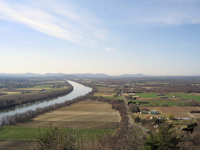
View from the top of Mt. Sugarloaf, looking south toward the Holyoke Range. That range is a set of east- to south-dipping cuestas, made of the Jurassic Holyoke Basalt lava flow, which is up to 200 m thick. The Connecticut River is to the left. The flat valley floor is covered with glacial lake sediments (Glacial Lake Hitchcock), and so is very flat, fertile, and free of rocks.

Small scale cross bedding (center) in coarse sandstone.
Stop 2
This is an outcrop of varved glacial lake sediment, exposed to the east of North Sugarloaf Mtn. This outcrop has spectacular, thick varves that represent annual layers deposited by: 1) sand from swift-flowing spring runoff, 2) silt deposited during the summer melting season, and 3) clay deposited during the winter.
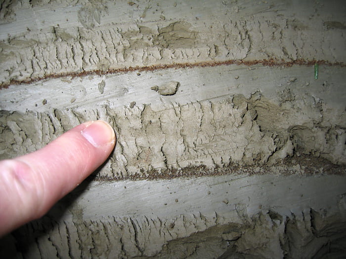
Here the varve structure is clearly seen. A thin layer of sand is on the bottom, from swift spring meltwater and possibly ice rafting. The sand is followed by a silty summer layer, which has a series of vertical cracks where the trowel cut through to smooth it off. The winter clay layer is grayer than the slightly browner silt layer, and was cut smoothly by the trowel.
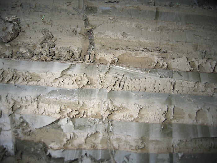
A wider view showing several complete varves. Notice that not all of the varves have sand at the bottom, but they all have silt/clay couplets.
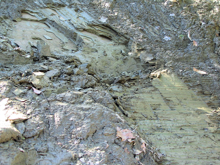
Near the top of the outcrop is an overturned fold made of varved lake sediments. This is presumably from a down-slope slump. To the lower right are flat-lying, undisturbed varves. Above and to the left are steeply dipping varves on one limb of the fold. The fold hinge is very tight, and is located at the contact between deformed and flat-lying varves, unfortunately obscured by debris.
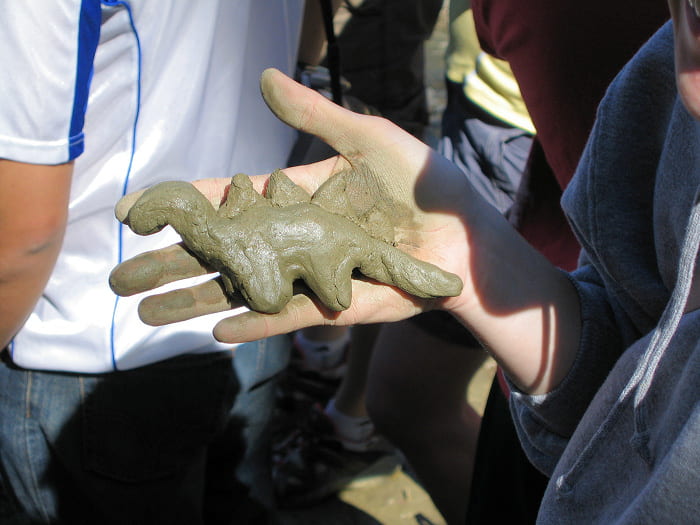
The clay is quite sticky, and it can pull your boots off if you’re not careful. It makes nice modeling clay, though I understand it is no good for firing. The rocks under the glacial sediments are Jurassic here, certainly a good time for dinosaurs.
Stop 3
Top of the Sunderland Delta, a sand and gravel delta that was deposited by glacial meltwater into the eastern margin of Glacial Lake Hitchcock. Naturally there are lots of sand and gravel pits in such deltas.

Wide view of the pit operation. The lake was to the right, so the river water that made this deposit flowed from left (east) to right.

Closer view of some of the foreset beds on the far side of the pit, and even a glimpse of topset beds on the southeast margin of the pit.
Stop 4
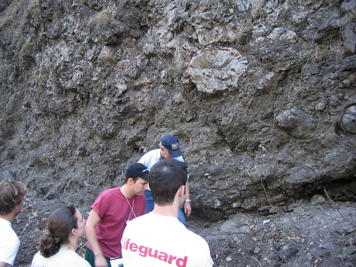
Coarse depositional breccia at Roaring Brook, just east of Mt. Toby and immediately west of the Connecticut Valley eastern border fault, the Mesozoic normal fault along which much of the Connecticut Valley basin subsidence occurred. The breccia is probably talus or proximal alluvial fan material.
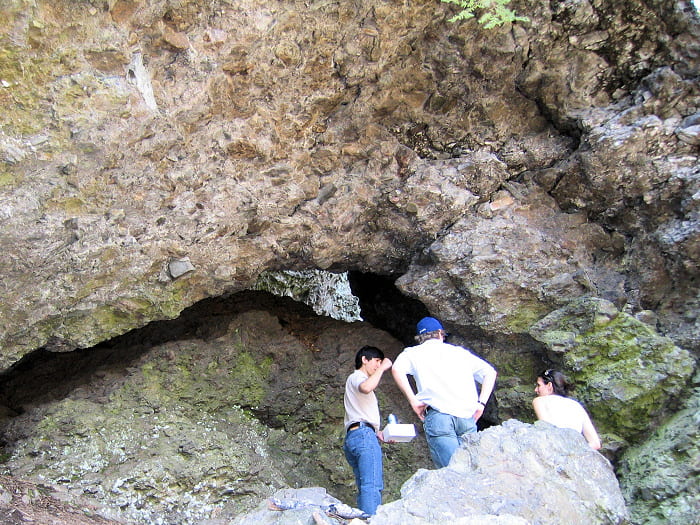
Coarse breccia with angular clasts, exposed in an overhang. A fallen block exposes a nice little cave.

Close-up of some angular clasts in the breccia. Most seem to have been transported at least a short distance, so I would guess that this is a proximal alluvial fan deposit rather than talus. The clasts are mostly phyllite and low-grade schist, with some quartzite and granite.
Stop 5
Barton Cove is a small park on the west side of the Connecticut River in Turners Falls, between Rt. 2 and the river. The bedrock ridge that makes up the park was a temporary glacial meltwater spillway, so there are deep plunge pools on the downstream side. The photos below show breccias and folding in Jurassic redbeds, which are unusual. The redbeds here dip at about 30°, but in general are otherwise undisturbed. There is considerable question as to the origin of the local deformation. The main ideas are:
- Earthquake-initiated slides of relatively soft, wet, gently dipping fluvial and lacustrine sediments.
- Dewatering structures where water escaping from compacting sediments deep down disrupted the layering in pipe-like or sill-like structures.
- Small thrust faults associated with compression or transpression late in the rifting episode that made the Connecticut Valley basin.
No conclusion was reached on the field trip, but there were people working on it. All photos at this stop were taken from a small area ~50 m across, uphill from the northeasternmost plunge pool. All the photographed areas are within sight of one another.
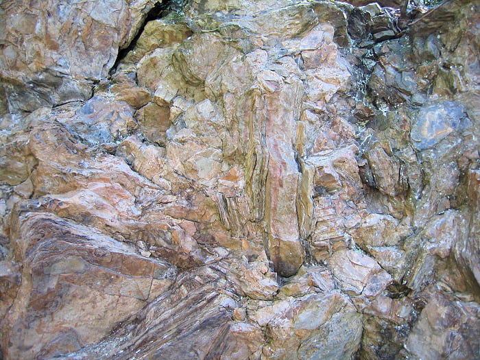
Local breccia zone where sandy layers were disrupted in a more shaley matrix. The fragments are quite coherent and don’t really resemble deformed soft sediment. Unless, of course, these were semi-lithified broken blocks in soft sediment mush.
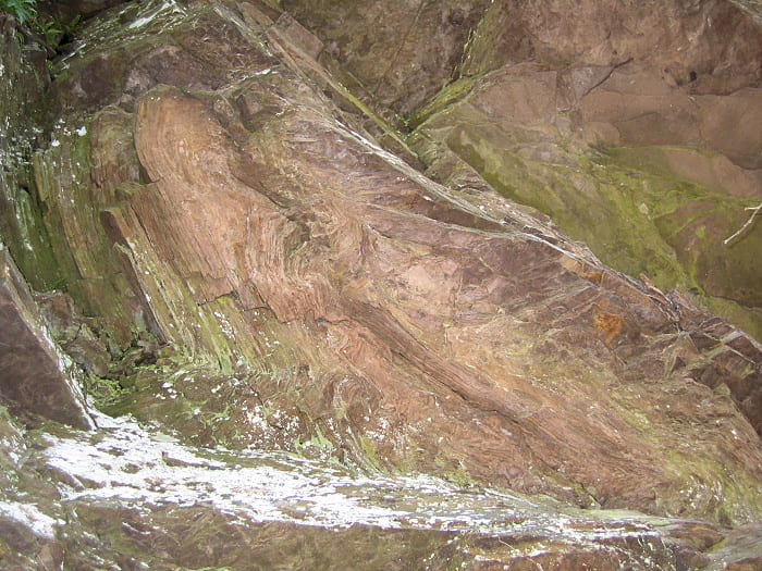
Folded fine-grained sandstone.
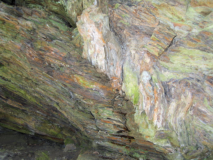
Kink folds in shaley sediments.

Another fold in fine-grained sediments.
Stop 6
Road cut along Rt. 2 in Turners Falls. The primary rock exposed here is the Deerfield Diabase, composed of two lava flows having a combined thickness of 55 m. I think the two flows are from the same eruptive episode. Jurassic red beds are exposed above and below the lavas. The base of the flow is made of pillow lavas in a fragmental matrix, probably formed as the lava flowed into one of the saline lakes that periodically occupied parts of the rift valley floor. The top of the flow is highly vesicular, and the contact between the two flows is highlighted by abundant vesicles.
Pillow lavas in a fragmental matrix at the base of the Deerfield Diabase flow. The contact with the underlying redbeds is in the notch to the lower right.
Some of the lava pillow in a fragmental matrix, ~5 m above the base of the flow.
Upper contact of the lava, lower-left, with Jurassic red beds above. The lava is the rounded surface at bottom center, where the tiny white specs are filled vesicles. The red beds to the upper right are layered, dipping down at ~35° to the right.
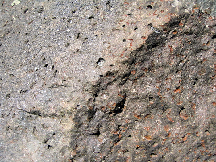
Close-up of the vesicular basalt near the top of the flow. Vesicles are filled with minerals, including green material (chlorite?), white low solubility material (zeolite?), and carbonate (calcite?). Many of the vesicles on the surface have had their filling weathered out.

Fresh surface, where the vesicles are mostly filled with greenish material. The petrology of this flow, here at least, is a complete, hydrothermally-altered mess. Don’t expect to find much in the way of the original minerals.

Successive fracture steps that formed as this joint surface extended along the cooling front, during cooling of the lava flow. Nice columnar jointing, however,is not present at this outcrop.

The middle part of this flow has several nicely exposed coarse compaction sills. Here you can see the fine-grained rock (below) and coarse-grained rock (above) in the compaction sill. As I recall from publications by Tony Philpotts, these form after the lava becomes a weak, non-convecting mush as growing crystals start to touch. The crystalline mush is denser than the interstitial liquid, so it tends to compact and sink, as the interstitial liquid rises. The mush fractures typically along subhorizontal surfaces, and these fill with the rising interstitial liquid. The initially crystal-free, incompatible element-rich, volatile-“rich” liquid filling the sill can then grow relatively large crystals because of few nuclei.