The Absaroka Volcanics are the eruptive products of a large Eocene volcanic field in Montana and Wyoming. The province has ~13 major eruptive centers, each of which includes lava flows, pyroclastic deposits, and dike swarms. The volcanics on Mt. Washburn are calc-alkaline and bimodal, with basaltic andesite predominating. Dacite is more common in the lower parts of the section. True basalts and rhyolites are not found on Mt. Washburn.
Of lavas studied to the date of this trip, there is no evidence of substantial disequilibrium among the phenocryst populations. This suggests that either basalt-crustal melt magma mixing was not an important process in the generation of these volcanics, or that the magma had a long enough residence time to destroy evidence of disequilibrium. Some other Absaroka volcanics, however, have disequilibrium phenocryst populations. Later, the Absaroka Volcanics here were covered by Pleistocene pyroclastics from the Yellowstone calderas. These have been eroded away from the Mt. Washburn area, thus exposing the older, underlying rocks. The remaining Mt. Washburn volcanics are ~1300 m thick. The southeastern flank of the Mt. Washburn volcano is missing, having been dropped down into one of the Yellowstone caldaras. Presumably the missing rocks are still present, somewhere deep inside the caldara.

Topographic map of the trail we took up Mt. Washburn. NOTE: Remember that this is a national park. No sample collecting without written permission from the NPS!
Stop 1. Layered volcanics

Outcrop of two-pyroxene pyroclastics. Lower part of the outcrop is better consolidated and less vesicular than the upper part. The contact exposed on the outcrop is visible texturally, and the change in slope on the outcrop surface was caused by faster weathering of the upper layer.
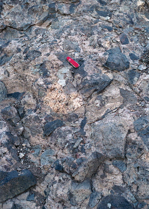
The upper layer in the outcrop above. Darker blocks are dense rock with few or no vesicles. Pyroxenes are visible as black specks. Lighter blocks are altered vesicular fragments. The matrix material is fine-grained ash, in some cases layered.

Close-up of some of the altered matrix material (light-colored, top) and a layered block made of denser, dark-gray and browner, more vesicular layers.
Stop 2. Dike and lava flow in pyroclastics
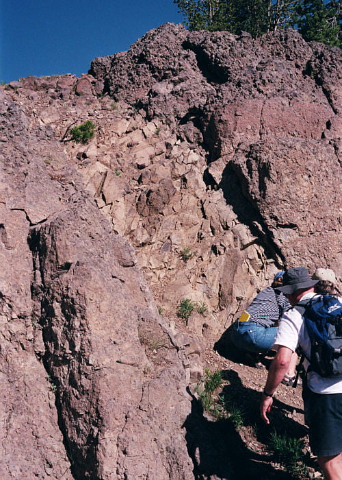
Andesite dike cutting pyroclastic rocks. Columnar jointing in the dike is poorly developed, but perpendicular to the dike contacts. Dikes like this are more or less radial from the presumed volcanic center, represented by a some small tonalite bodies just to the southeast of Mt. Washburn.

Pyroclastic rocks cut by the dike in the image above.
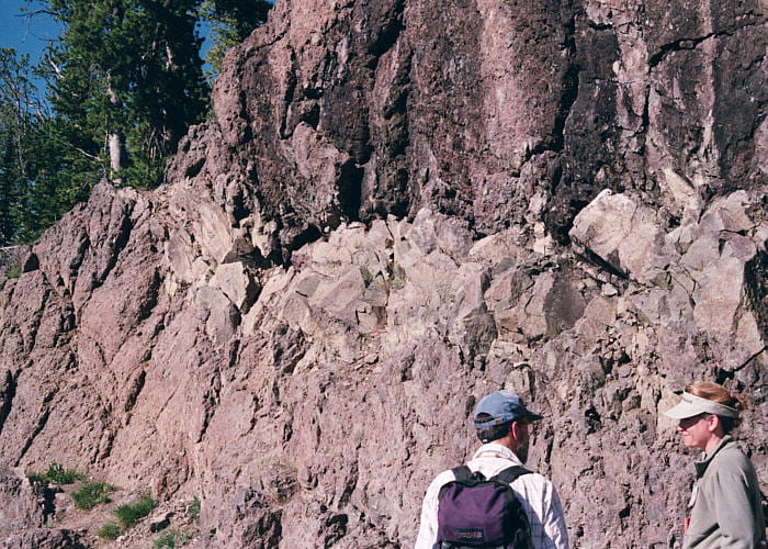
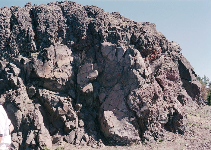
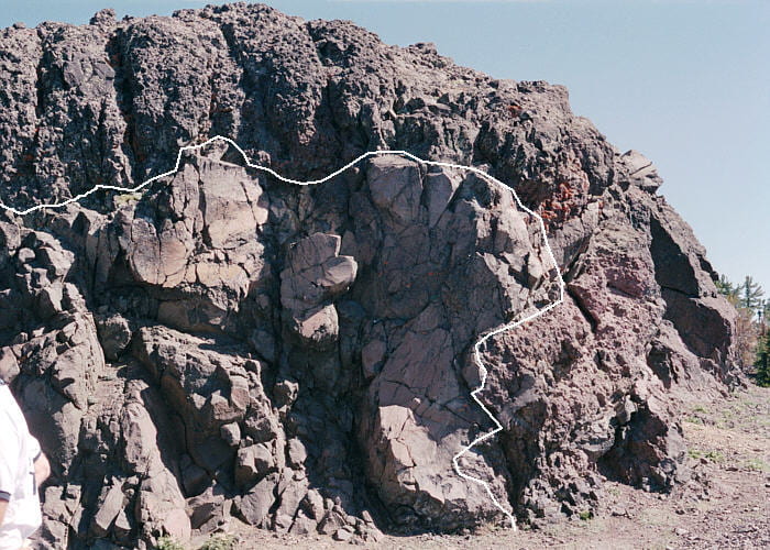
Lava flow (or possibly a sill) in the pyroclastics, shown in the two images above. The flow has sharp and rather irregular contacts, top and bottom, and doubtless represents the dense rock of a flow core, with its own aa rubble above and overridden rubble below. The flow seems to pinch-out just short of the dike.
Stop 3. Lava flow and ramp structure
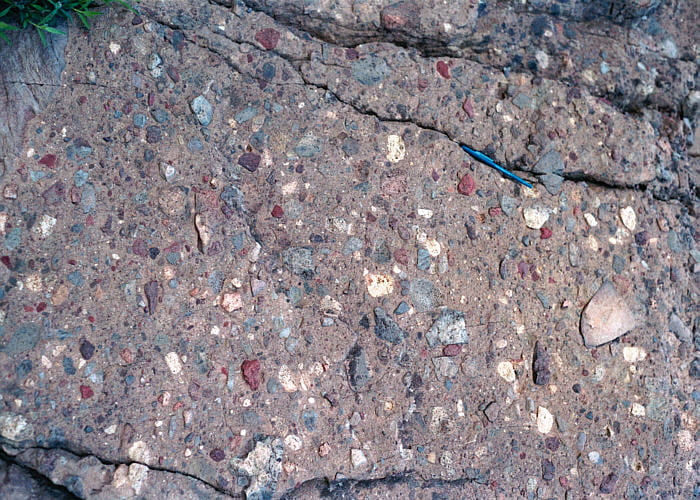
Exceptionally colorful layer of pyroclastic debris, or possibly a mudflow deposit.
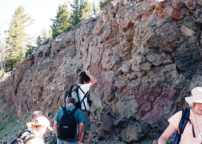
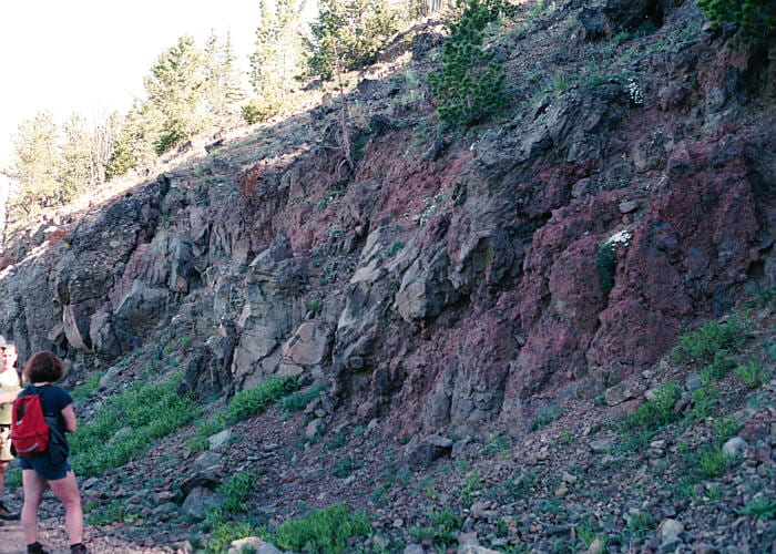
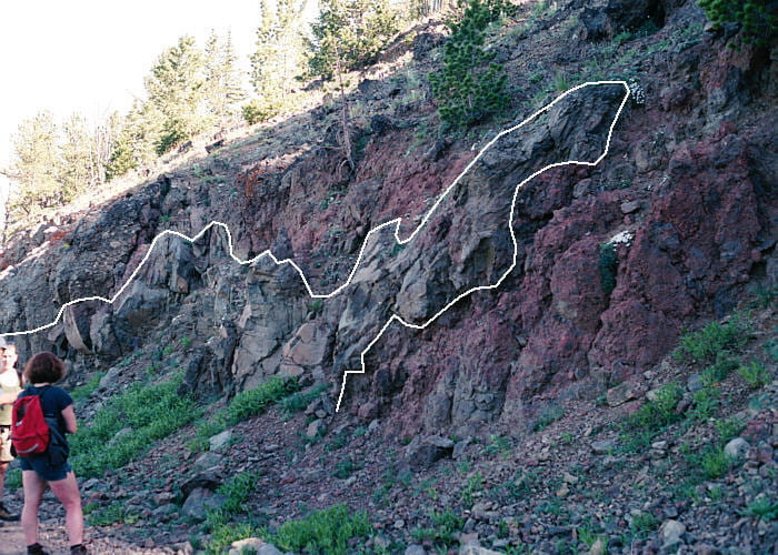
This outcrop is interpreted to be a cross section of a basaltic andesite lava flow. The dense rock at the bottom is the lava flow core, that solidified after movement ceased. It’s overlain by its own rubbly aa lava top.
A view of the same lava from higher up. The red material is the rubbly aa flow top, which is partially overridden by the dense, gray core rock at the flow front, in the center-right of this image. This is known as a ramp structure. Click on one of the arrows to see an outline of the flow core.
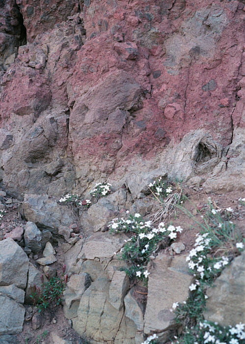
Close-up view of the lava flow, showing the dense flow interior rock in the lower half of the image (with flow banding), and the rubbly aa flow top material in the image top half.
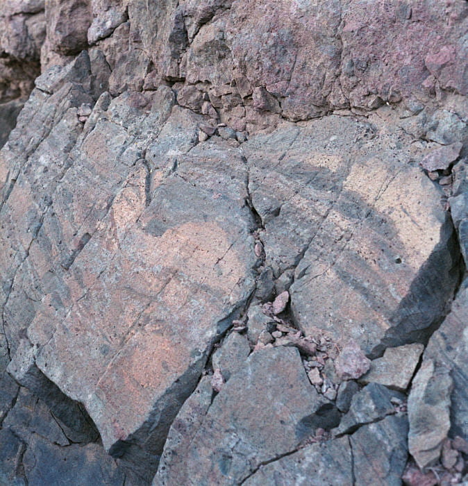
This may be the same flow as seen in the three images above, farther up the trail. Irregular layering like this was said to be typical of “spatter-fed flows”. Those are flows fed in large part by air fall of molten lava spatter, as from a spatter cone. Maybe in this case more of a splutter cone.
Stop 4. Scenic overlook, and another lava flow
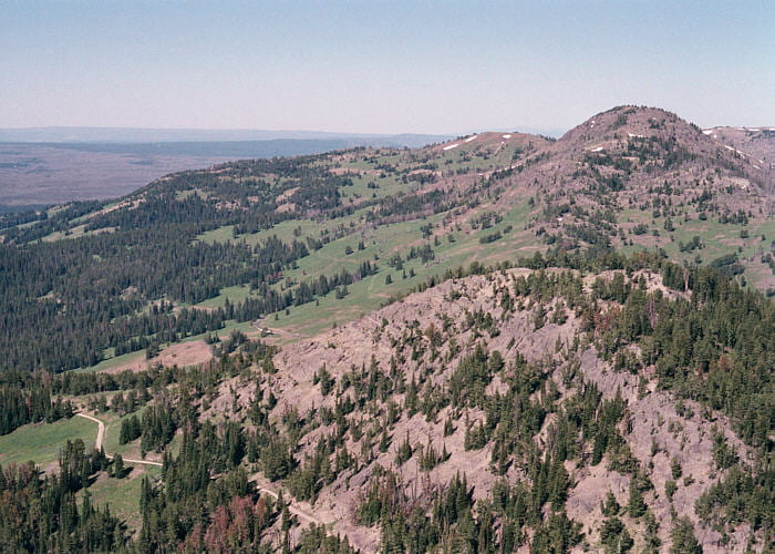
Looking south along the extended ridge of Mt. Washburn from a switchback in the trail. On the near hill, some of the beds can be seen with their rather steep northward (right) dips.
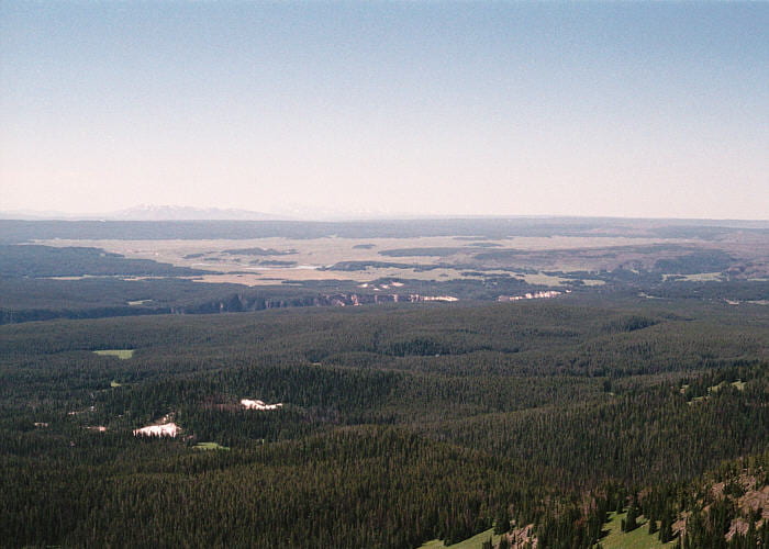
View to the southeast from Mt. Washburn. The Grand Canyon of the Yellowstone River is in the middle distance. The white patches in the near distance are hydrothermally altered rock in the Washburn hydrothermal field. The Sulphur Creek tonalite stocks, thought to mark volcanic feeders for some of the local Absaroka volcanics, are near, but much older than and unrelated to this hydrothermal field.
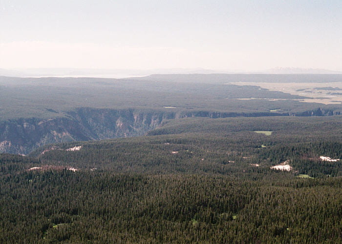
View to the east, also showing the Washburn hydrothermal field and the Grand Canyon of the Yellowstone River.
A flow front behind the scenic overlook, which again consists of a dense lava flow core overlain by and overriding its own aa rubble. Click arrows to see an outline of the dense flow core.
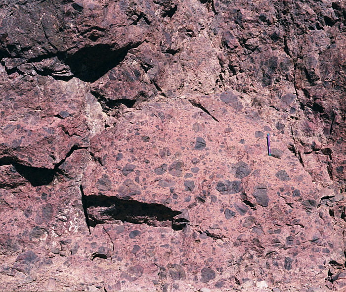
The rubbly material at the front of the lava flow in the image above.
Stop 5. Radially fractured block
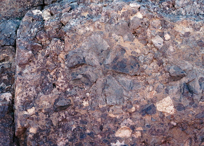
Radially fractured lava block, interpreted as evidence that this pyroclastic block was hot at the time of deposition. The fractures formed during cooling.
Stop 6. Fragmented lava and clastic dike
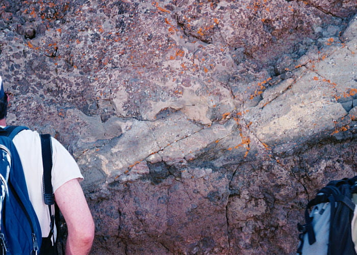
Layered, light gray, apparently water-lain volcanoclastic sediments that overlie dark-red pyroclastics. Above the water-lain sediments is an odd mix of volcanoclastic sand, in part layered, and fragmented lava. The suggestion here was that this represents a lava flow that flowed into a stream flanking the volcano, causing boiling, lava fragmentation, and mixing of some of the lava and unconsolidated sediment. A clastic dike can be seen just to the right of center, apparently extending downward from the mixture above into the pyroclastics below the light-gray unit.

Closer view of the light-gray volcanoclastic deposit, composed of sand and pebbles. At the top left is the lowest part of the sand-fragmented lava mixture, and in the center and extending to the right and downward is the clastic dike. There was some controversy as to whether or not the dike extends from the top downward or the reverse. I think it extends from the top downward, because the dike material, with its ~50% sand component, looks more like the mixed material above, not the pyroclastic layer below.
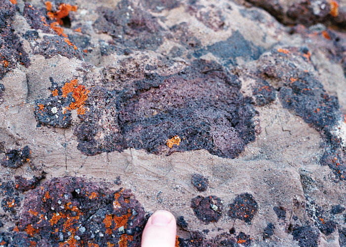
Close-up view of the fragmented lava, surrounded by layered sandy sediment. Such thin layering and clean sandy sediment would not be expected in a mudflow.
Stop 7. Scenic overlook near the summit
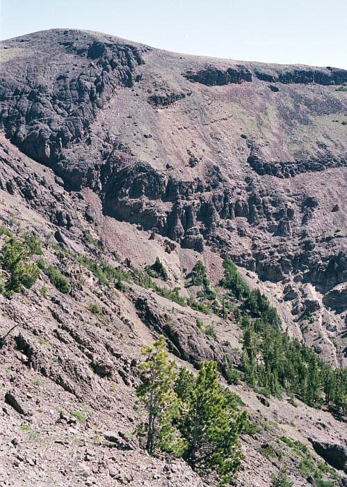
Northwest (left)-dipping flows on the east side of Mt. Washburn. The pyroclastics on the top left of this image are at a crosscutting relationship to the pyroclastics and lavas in the center and right. The contact may be an erosional channel or fault. The trip leader suggested that it was a landslide scarp, later covered by eruptives.
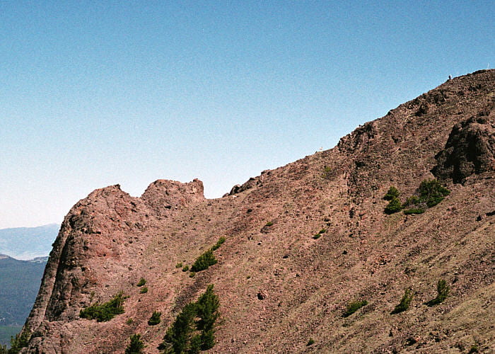
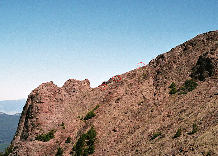
North flank of Mt. Washburn. The deepest notch marks the path of a wide composite dike that crosscuts the pyroclastics and lavas. A few distant bighorn sheep can be seen near the center of the image (click arrow to see where).
Stop 8. Mt. Washburn summit
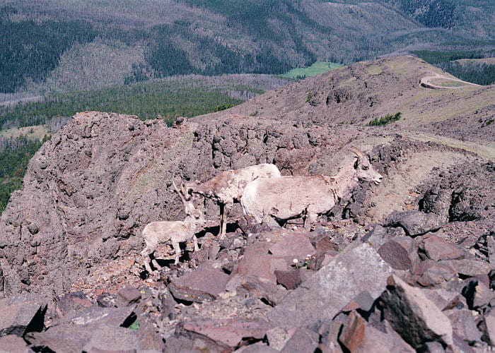
Bighorn sheep near the summit of Mt. Washburn. The valley below is west of the mountain. The road to the right goes down the mountain on the northern side, whereas we hiked up the southwestern side.

View from the summit of Mt. Washburn toward the southeast, into the broad, flat center of the Yellowstone caldara complex. The Grand Canyon of the Yellowstone can be seen cutting across, just above the top of the ridge on the left.
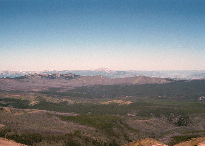
View to the northwest of Mt. Washburn, from the summit. The high peak in the middle horizon, is Electric Peak, another of the Absaroka volcanic centers. Electric Peak is barely within the northern boundary of Yellowstone Park.
