LWB dolomite quarry, Ledger Formation
This quarry is mostly in oolitic limestone of the Cambrian Ledger Formation. The quarry is in a part of the Ledger that has been dolomitized, to make some of the purest dolomite rock in the world, typically ‹0.7% non dolomite material, including quartz and clay. The dolomite itself is white, contrasting with the gray limestone that surrounds it. It is thought that the limestone was dolomitized soon after deposition via the arid tidal flat refluxing mechanism. The contact between the limestone and dolomite is quite sharp from a distance, though I never saw it up close. The highest quality dolomite is used for manufacturing refractory materials. The dolomite is crushed and then roasted to drive off CO2 to give a mixture of mostly lime and periclase. This is then pressed and sintered into product shapes. Lower quality dolomite is sold for agricultural purposes, crushed stone, and other products. Even the weathering residue overlying the dolomite and limestone is sold. Overall, it seemed to be a very efficient operation with essentially no waste material. Other than a big hole.
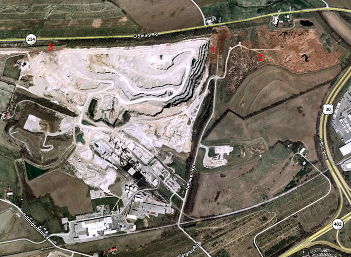
Google Earth view of the quarry. The main quarry pit is in white dolomite, on the left. The carbonate rocks have a thick red clay-rich weathering horizon above them, which is excavated and sold for things like landfill caps. Where this has been excavated (upper-right), pinnacle karst is exposed. We went to three locations: 1 overlooks the quarry to the west, with some pinnacle karst exposed in the brown area immediately to the east; 2 is in pinnacle karst where the weathering horizon has been removed; and 3 is a place where faults down-dropped a small sliver of Triassic conglomerate into the west end of the quarry

Two core samples from the quarry. The upper is dolomite, and the lower is limestone.
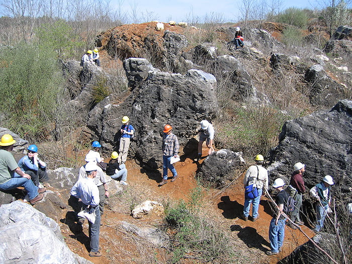
Area 1, eastern end of the quarry
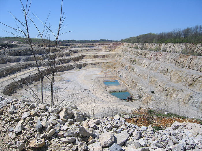
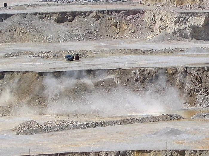
View of the quarry, looking east. The brownish rocks on the right side of the far end of the quarry are the Triassic conglomerates in a small graben. Blasting will occur on the 3rd bench on the far end on the quarry, and the 4th bench on the left side.
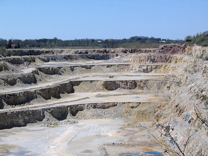
Closer view of the far end of the quarry. Note the truck and adjacent “diving bell” protection hut in the center on the 3rd bench. The face in front of them will be blasted.
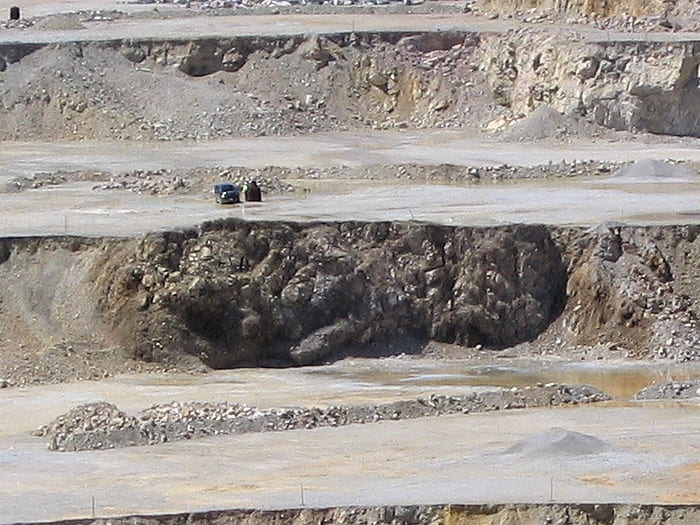
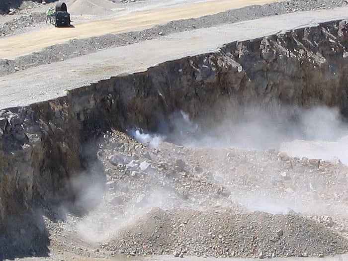
Seven holes were shot about 1/2 second before this photo was taken. Rock is lifting off the working face.
Blasted face about 10 seconds after the blast, which broke up about 7000 tons of rock. Each of the 7 drill holes has 5 samples analyzed from it. The quality of the dolomite in each hole allows the rubble to be subdivided by quality along its length for different processing and products.
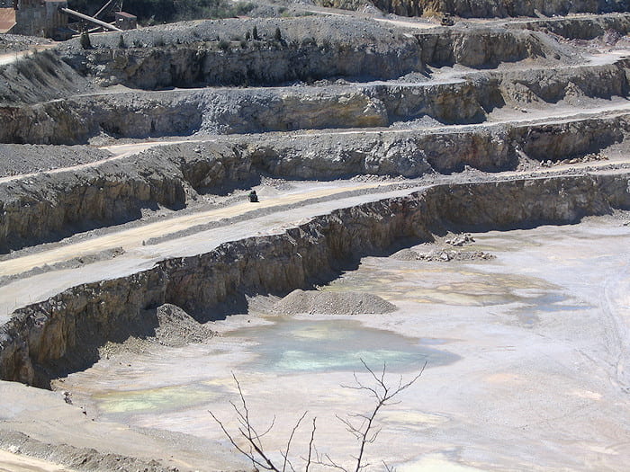
Here the truck has driven around to the 4th bench on the south side of the quarry, and the working face to its right will be blasted.
About 1/2 second after detonation, with rock lifting off the face. “Diving bell” protective hut is behind the truck.
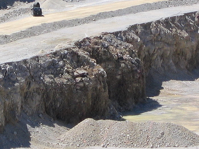
About 10 seconds after the blast. The man who initiated the blast is to the left of the truck.
“Diving bell” protective hut on the east end of the quarry. Each of these looks different, made at different times from materials that happened to be available.
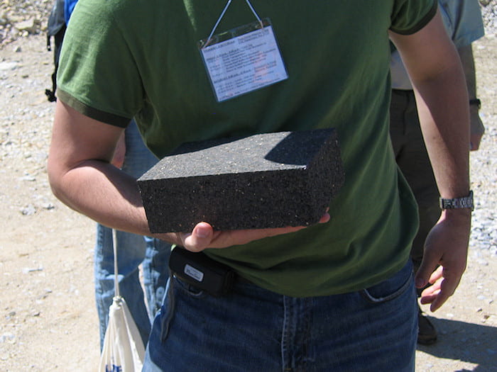
Refractory brick made of roasted, sintered dolomite, now a mixture of lime and periclase, colored with minor iron oxides that naturally occur in the original rock. These are used, for example, to line iron smelters.
Area 2, eastern area excavated to reveal pinnacle karst limestone
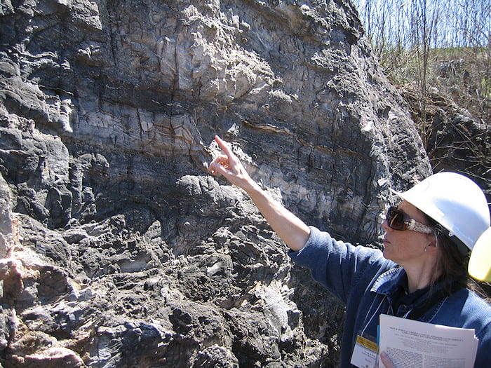
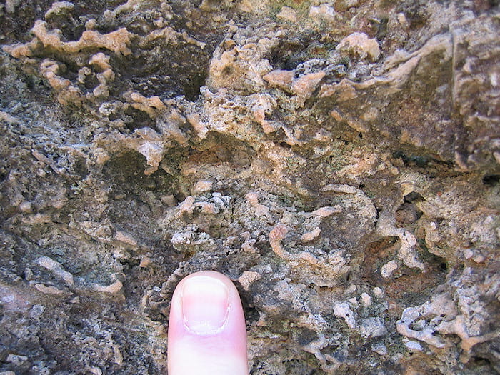
This rock is limestone made mostly of fossilized microbial mats, with more familiar stromatolites being less common. It formed in somewhat deeper water than the dolomitized rock, and escaped dolomitization that the oolitic shoals experienced. The rock retains, in exquisite detail, microbial mat growth and disruption features. Here, the dark layers are the microbial mats, the dark coloring being caused by residual organic material. Some of the light-colored layered material is in situ precipitated calcite that filled void space, as oxygen bubbles lifted mat layers off the bottom.

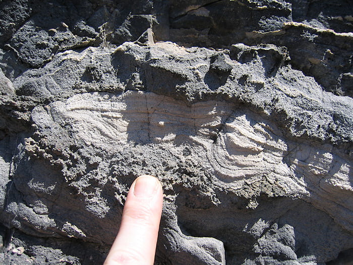
Closer view of the mat layers and partially concentric, void-filling calcite precipitated in situ. I believe the more featureless, light-colored layer to the upper right is a deposit of carbonate grainstone.
Close-up of one of the voids opened by mat flotation, filled with concentric layers of void-filling calcite. It’s my understanding that the outermost layers of calcite are fibrous, perpendicular to the void inner surface. The fibers inwardly coarsen to equant calcite, though not generally to grains >1 mm in size (but see photo below).

Inward-coarsening void-filling calcite, filling one of the void spaces opened by mat flotation.
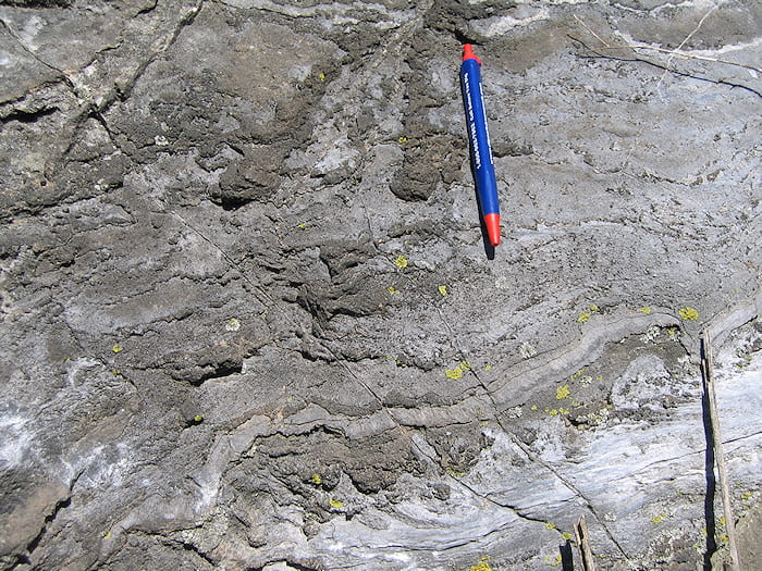
Tilted microbial mat layer. These mats are commonly not flat, because of their rising and sinking as oxygen bubbles come and go, and as currents shift the mats. The light-colored patches are made of void-filling calcite.
Close-up of textures in one of the microbial mats. A lot of these things look like burrows to me, but I don’t pretend to actually know anything about microbial reefs so I won’t say more. My ignorance probably caused me to miss photographing lots of impressive features. Sorry! There are fossils of other organisms in these mats, such as trilobites, but I didn’t see any.
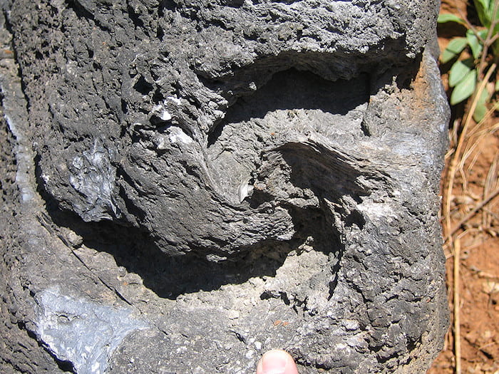
An interesting feature that was interpreted as a microbial mat that was rolled over on itself, perhaps by storm-induced waves.
Microbial mat layering with some void-filling material, and more featureless light-colored material, possibly carbonate grainstone along with microbial mats of variable thickness. Odd crosscutting features to the left of the pen may be a little infilled tidal channel, or maybe a rip in some mats.
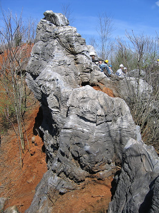
All of these microbial mat features are on karst pinnacles, that were exposed as the overlying weathering residuum was excavated for sale as landfill cap material. There are caves under the pinnacles, as indicated by occasional open holes.
Pinnacle karst from the top of one of the pinnacles.
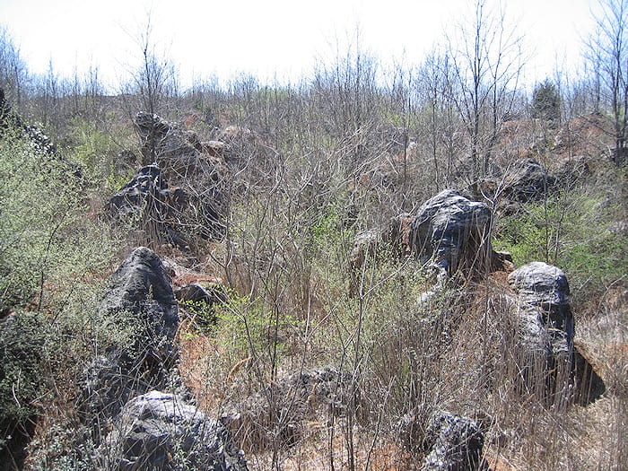
View to the south into more excavated pinnacle karst landscape.
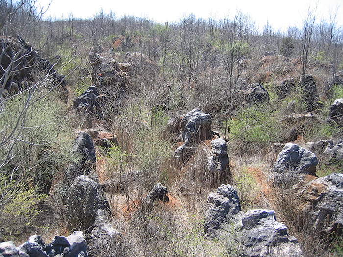
Another view to the south into excavated pinnacle karst terrane.

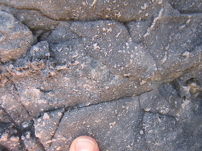
Pinnacle karst exposed near site 1, at the east end of the quarry. Some of this rock is dolomite (white, to the left and in the distance) and the rest is limestone (gray, to the right and foreground).
Area 3, small graben of downdropped Triassic conglomerate

Angular clasts in Triassic conglomerate, exposed in a small graben in the NW corner of the mine pit.
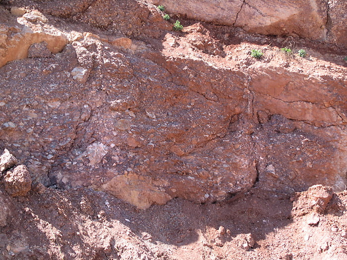
The conglomerate is crudely layered. Some of it, like here, ranges in size from sand to pebbles and is probably fluvial in some sense, such as on an alluvial fan. Other layers, like in the picture above, have clasts supported in a mud matrix. These may be mudflow deposits.
Slickensides along a fault surface, indicating largely strike-slip movement. This fault is not on the graben sides, but within the graben.

Fault contact on the east side of the graben. Dolomite is the brownish material to the right, conglomerate is the pinkish material to the left. White material along the fault (bottom center) suggests hydrothermal alteration by fluids moving along the fault.

Coarse conglomerate in the center of the graben.

Fault contact on the west side of the graben, also showing slickensides (right) that are on a surface about 90° from the main fault. Dolomite is to the left, conglomerate to the right. Slicks indicate largely strike slip movement.

Central portion of the graben, which here can’t be more than about 70 m wide. The white blocks behind the people are dolomite, which the conglomerate unconformably overlies. The unconformity is about halfway between the hardhats and the top of the slope.

Another view of the unconformity within the graben. The light pinkish-gray material in the lower right quadrant of the image is dolomite, and all the rest is conglomerate. The fact that conglomerate lies above the dolomite in the center part of the image, but to the left there is only a vertical wall of conglomerate, indicates either a rough unconformity surface or another little fault about 1/3 of the way from the left side of the image.

Small nest of carbonate crystals in a vein in the conglomerate. This is more evidence of hydrothermal circulation. Also, in parts of the quarry is material referred to as “marble” that is actually hydrothermally de-dolomitized rock, now made of calcite. We didn’t see any on this trip. It wasn’t clear to me if the de-dolomitization occured in the Triassic, or much earlier during one of the three major Paleozoic orogenic events (Taconian, Acadian, Alleghenian).
View across the west end of the quarry. The light-colored rocks to the left are dolomite, the gray to the right are limestone. Note how sharp the contact appears to be.
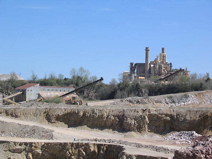
View of the processing plant from the west end of the quarry.