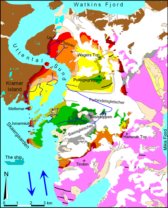
Day trips in chronological order, 1/9/2001 to 13/9/2001. Each trip is also accessible by clicking the appropriate parts of this map. References and links to thin section photographs are omitted here, for those see the geologic features page.

The trips are in chronological order.
- The ship
- Trip to Greenland
- Homestead site, UZa and trough layering
- Bad weather day, Archean gneisses
- Uttental Plateau, crossbeds and replacement textures
- Pukugagryggen and Mellemø Island, triple group and MBS
- Basistoppen circuit, UZb, UZc, and sandwich horizon
- Kraemer Island 1, autolith blocks in LZb and LZc
- Mikis Fjord macrodike
- Ivnarmiut Island, MBS-Layered Series contact
- Kraemer Island 2, MBS, autoliths, and xenoliths
- Return to Iceland
Geologic map of the Skaergaard region (after McBirney, 1989). For an explanation see the geologic map page.
